
NOAA app crowdsources flooding data and turns tablets into emergency response tools
By Ben Young Landis
In the United States, flash floods kill more people than tornadoes. Tornadoes have earned an air of infamy given their typical visibility, yet flash floods present a more subtle, less predictable, and less understood storm hazard.
These facts dominate the mind of J.J. Gourley, a research hydrologist at the National Severe Storms Laboratory (NSSL) in Norman, Oklahoma. NSSL is a federal research laboratory of the National Oceanic and Atmospheric Administration (NOAA) tasked with improving forecasting and hazard warnings for severe storm and flash flood events in the United States.
Gourley and NOAA collaborator Zac Flamig are recipients of a 2015 Sharing Solutions grant offered by the AGU Thriving Earth Exchange in partnership with Amazon Web Services, the cloud computing subsidiary of the e-commerce company. Through a new app, the two storm scientists hope to improve flash flood response across the country — by putting the combined forecasting power of 160-some weather radars in the palm of any emergency manager — while activating those managers into a network of flood damage observers, collecting crucial data on the triggers, trends, and magnitudes of flash floods in different regions.
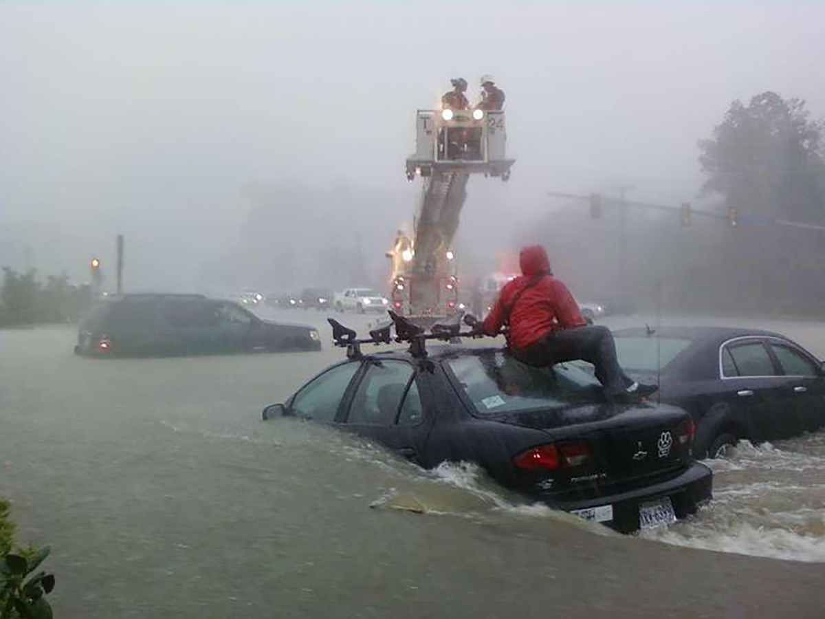
Flash floods can form with astonishing speed and power. A new NOAA app aims to help emergency managers better understand flooding patterns and improve emergency response, and collect observations such as this citizen-contributed photo. (Image courtesy of NOAA/NSSL)
Temperamental Torrents
“When we see a storm coming on radar, we don’t always get clear indicators about the immediacy of the threat of flash floods, as you would a tornado,” says Gourley, who also teaches as a meteorology professor at the University of Oklahoma. “And the numerical weather prediction models we use for storm prediction are not very good for picking out storms that would produce flash floods.”
That is because while flash floods owe their genesis to rainstorms, their severity also is impacted by the local hydrology — how quickly water can be absorbed by or can flow over the land surface. “A tornado doesn’t care much about what’s below it — it’ll just go right through everything,” says Gourley. “Flash floods depend on the natural landscape and the human engineering on top of it, like sewer designs and such. What may seem to be an innocuous urban area may be at higher risk for a flash flood, versus say, a sandy field.”
As for the deadliness of flash floods, Gourley points out that people’s behaviors play a big role in fatalities. “Eighty-one percent of flash flood fatalities happen when people intentionally drive into floodwaters; work on their homes, like trying to clear storm drains; or when they recreate in flood waters,” says Gourley.
So, public education is one half of the current gap in reducing flash flood hazards. The other half — the one Gourley and Flamig received the AGU award for — is to give emergency managers better access to flash flood forecasts for their region, and to help everyone understand the timing and potential of future floods.
A Mosaic of Radars
The AGU-awarded NOAA project is called FLASH — Flood Locations and Simulated Hydrographs — and Gourley attributes its success to two occurrences.
“Well, let me first take you back to 1998,” Gourley laughs. At the time, weather radar data were not being archived. As a University of Oklahoma researcher at the time, Gourley and his colleagues began to set up computer records of radar readings from different sites. “But instead of treating the data as from separate radars, we blended them into a mosaic.”
Because the geographic reach of individual radars often overlap with their neighbors, Gourley says it is possible compile all these overlapping data into one large, single mosaic. This means instead of relying on a single radar unit, a weather forecaster could now tap into continuous coverage from radars from across the region and country. The effort led to the creation of the Multi-Radar/Multi-Sensor System (MRMS), which can project rainfall rates and storm movements nationwide at a 1-kilometer spatial resolution and up to a 2-minute time resolution.
Before MRMS, flood forecasters relied on hourly rainfall rates. “But that’s not very useful for flash flood forecasts, since so many small headwaters respond well below one-hour intervals,” says Gourley. A flash flood could even begin and end within an hour’s time.
The University of Oklahoma and NSSL successfully transferred the MRMS software to NOAA’s National Weather Service (NWS) in 2014. By now a seasoned NOAA scientist, Gourley jumped at the chance to apply MRMS into something revolutionary for his current project, FLASH. “We started FLASH in 2012, with money from the Sandy Supplemental congressional hazards grant,” says Gourley. “That funding was meant to rapidly move ready-to-roll projects such as ours, and give it a ‘steroid shot’ to quickly move it into completion.”
Gourley now has that second occurrence to thank — discovering a young University of Oklahoma student named Zac Flamig in 2006.
“I hired Zac as an undergrad freshman and have taken him all the way to his Ph.D.,” Gourley says, with a mentor’s pride. “His job application caught my eye, and his computer skills were unequalled.” What impressed Gourley were Flamig’s precocious coding skills in combining and modeling radar data — skills which proved instrumental in scripting FLASH models — and the mobile app they would create next.
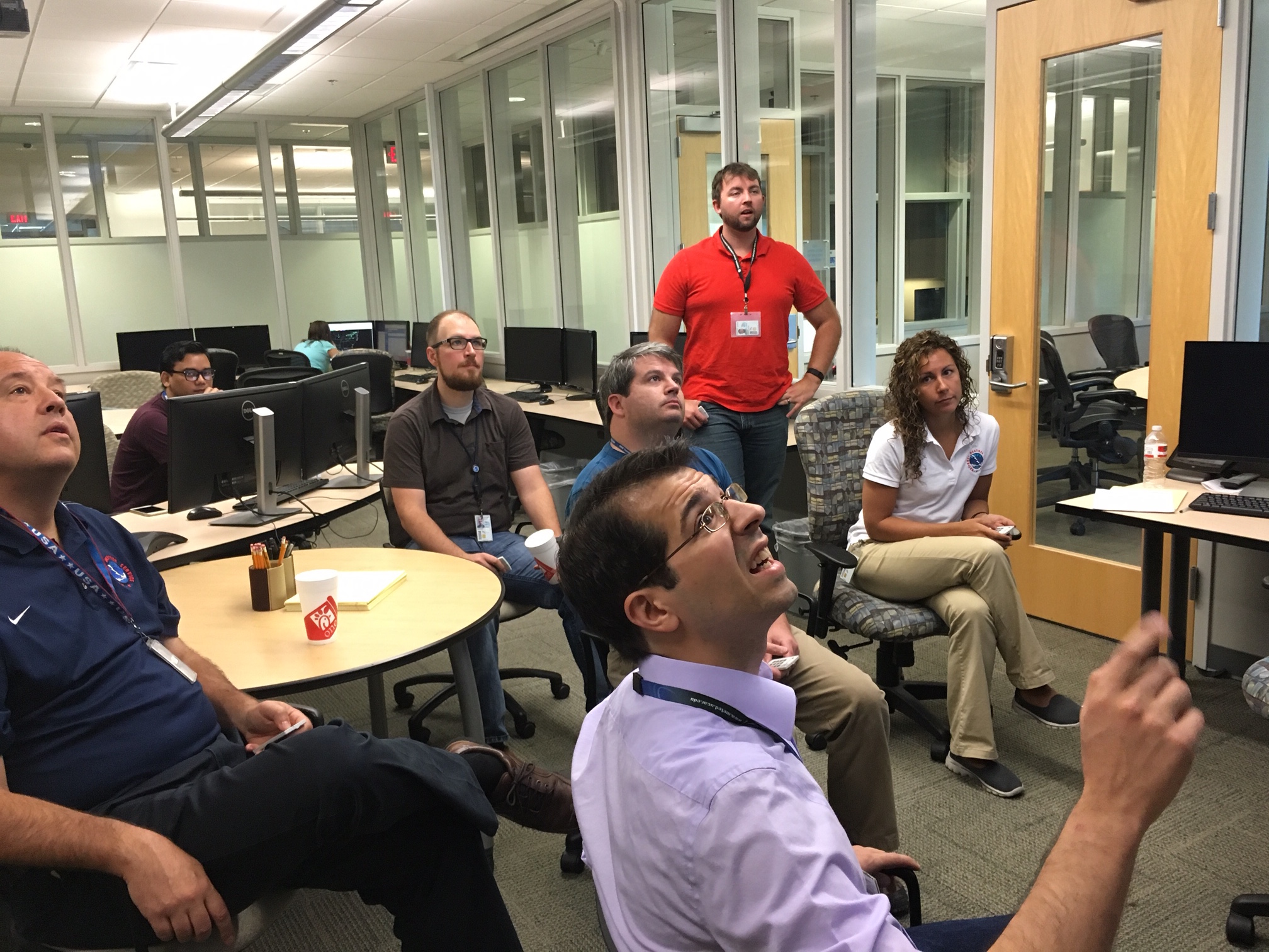
Meteorologists from across the United States gathered at NSSL headquarters in Norman, Oklahoma, to work with FLASH researchers in a “co-training” exercise in April 2016. (Image courtesy of NOAA/NSSL)
Powered by Crowds…
Coding by Flamig and the FLASH team transforms the MRMS mosaic into information that improves the accuracy, timing, and specificity of flash flood warnings by NWS forecasters, who are responsible for issuing hazardous weather alerts across the United States. In fact, NWS forecasters are regularly invited to Norman, Oklahoma, for a sort of “co-training camp” where forecasters test out new flood prediction models — using them to issue experimental warnings in real-time on real weather events — then offer researchers feedback on improvements and fixes.
That shores up the radar modeling end of things. But as Gourley points out, flash floods behave according to their landscape. So if the FLASH team wanted to truly improve hazard forecasts and help local emergency managers, they needed to build another mosaic — one that compiles actual observations of flash floods from events occurring around the country.
But flash flood observations are difficult to come by. “Unless it’s a big catastrophic one, they are not routinely surveyed,” says Gourley. So in the past three years, the FLASH team began to survey observations of flood damage and flood chronologies — tracking reported flash floods, then calling local emergency offices and the public afterwards to conduct questionnaires.
“One of the things we learned in that process is that no matter how good we get at flash flood forecasting, there are local nuances that are not going to be resolved by remote sensing, including radar,” says Gourley. “It seems like every community has a little trouble spot or a problem creek that are just too subtle. And there will always be certain landscape features that radar or satellite can’t pick out, such as storm controls and sewer design.”
Gathering observations through phone surveys is time intensive. But a mobile app could be created to fulfill this crowdsourcing function — and deliver localized flood forecast maps to users in one swoop.
So, the FLASH team made one; the iOS version is ready for testing, and the Android version is in development.
“We can provide those folks out there — the boots on the ground, the first responders — we can help them gain access to our forecast so they can better specify their responses,” says Gourley. “Not only that, the app will let them record the location, magnitude, specificity, and time of flood damage they’re seeing, so that we can incorporate that information in our model, and know that location is a trouble point.”
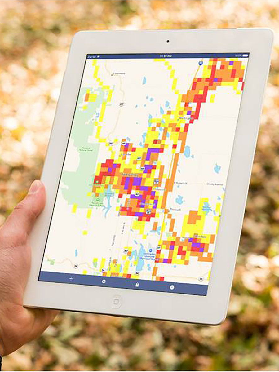
A simulated image of the FLASH app being created by to share flash flood forecasts with local and regional managers. (Image courtesy of NOAA/NSSL)
…And Powered by Clouds
Once the app is implemented, Gourley and Flamig hope to build up a knowledge base of geographically marked flooding trends — those trouble points — for each locality.
Deployment is where the AGU-Amazon Web Services partnership comes into play. Thanks to the award, Gourley says the new FLASH app could be run off of Amazon’s Elastic Compute Cloud, ensuring reliability of service and the computing horsepower to serve the 10.8 million grids of radar mosaic data from across the United States, efficiently streaming flash forecast maps, tile by tile, to a user’s mobile device.
Meanwhile, Amazon’s Relational Database Service could catalog the crowdsourced flood observations — relating time, type of flood impact, and photos of flood damage. Gourley also hopes to archive every FLASH model output and create a giant catalogue of flood scenarios — full circle from his MRMS days building archives of radar data.
Emergency management professionals will soon get to test out the FLASH app. The first community to partner with Gourley and Flamig will be Larimer County, Colorado — an area dense with tributaries and steep ravines, leaving cities such as Fort Collins prone to flash floods. Another co-training camp seems likely, letting local managers utilize the forecasting and recording tools in real-time situations, in exchange for feedback on how to refine the app for broader use.
“I believe that any collaboration with NWS regarding flash flooding has the potential to lead to better systems for warning and notification,” says Lori Hodges, Director of the Larimer County Office of Emergency Management. “Everything in the emergency management field first begins with research and scientific inquiry. From there, we can lay a foundation of knowledge to help develop plans and procedures for the safety of the community.”
Hodges adds that with the ever-changing world of technology, she finds it “important, now more than ever, to seek solutions to prepare for the risks and hazards of the future” — making Hodges a fitting partner for Gourley, Flamig, and their NOAA team, funded by a grant called Sharing Solutions.
Ben Young Landis is a freelance science communicator and a contributing writer for Creative Science Writing and the Thriving Earth Exchange.