
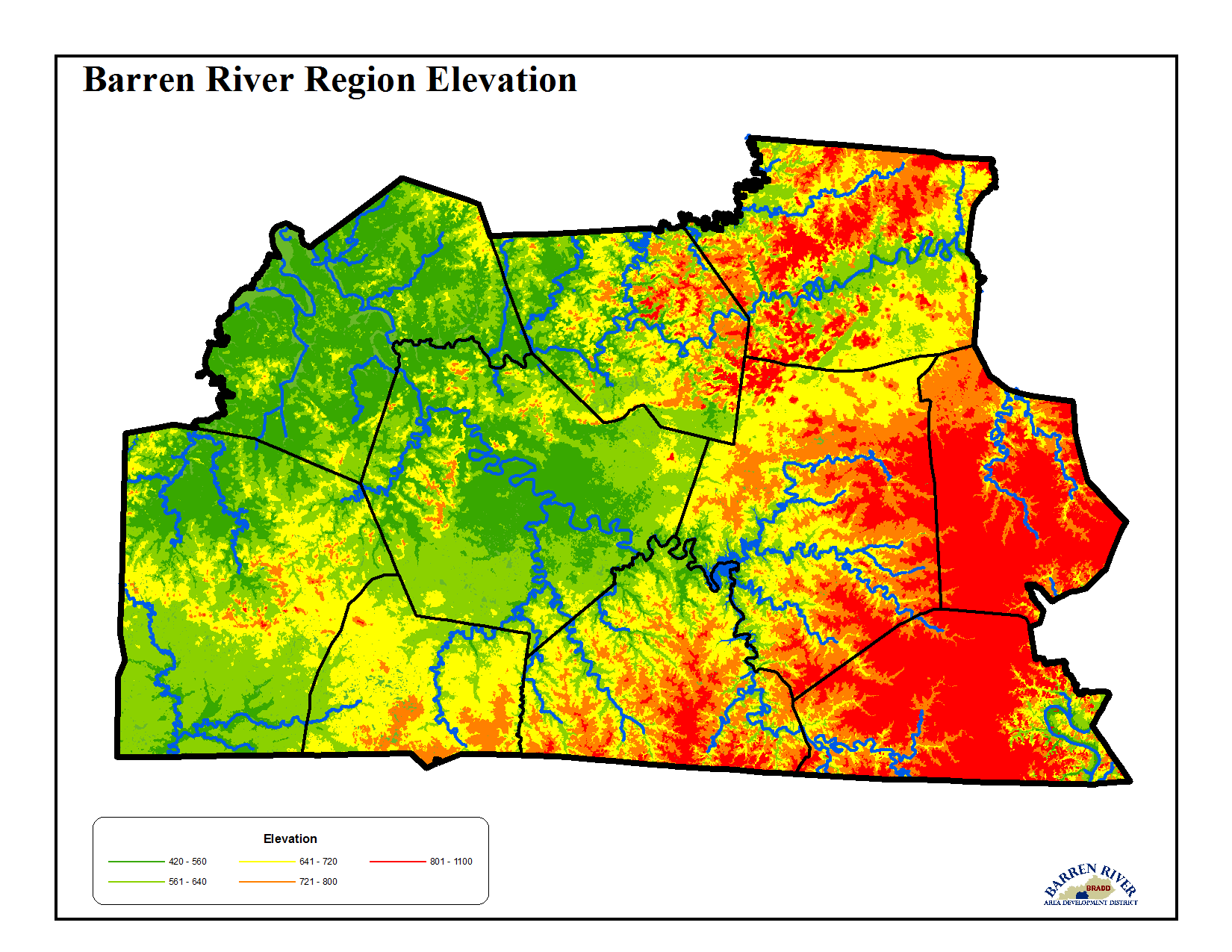
The Barren River Area consists of 2,542,811 acres (4,000 square miles) of flat to hilly terrain in the Pennyroyal region of the Mississippi Plateau in south-central Kentucky. Approximately forty percent of the area has a karst topography, which has endowed the region with many spectacular grottoes, sinkholes, and caverns, including Mammoth Cave National Park located in Barren, Edmonson and Hart Counties, considered the longest cave in the world. The other sixty percent varies from gently rolling loess deposited soil material, to steep residuum material. Elevations range from under 400 feet above sea level along the western Green River plains to over 800 feet in the eastern hills of Metcalfe and Monroe Counties.
The region is situated on the southeastern flank of the large geologic structure known as the Illinois Basin. Predominately Mississippian and Pennsylvanian rock formations are exposed at the surface throughout the region. Other formations in the region are of Silurian and Ordovician periods.