
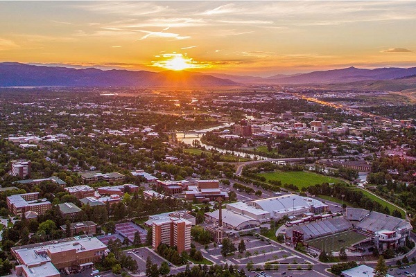
Image courtesy of Destination Missoula
Project Title: Mapping Heat Vulnerability
Location: Missoula, Montana
The Team:
The project team would also like to recognize the contributions from the wider community, especially Britt Holewinski (City of Missoula Sustainability and Zero Waste Educator) and University of Montana faculty and students.
This project was launched in May 2017 through Thriving Earth Exchange’s partnership with ICLEI USA, and in response to community concerns about longer and hotter summers, and their disproportionate effect on vulnerable populations.
Historically temperate, Missoula’s climate is forecasted to experience a 2-5oF increase in mean air temperature over the next 20-30 years. Rising temperatures and increasingly frequent and intense summer wildfires bringing smoke to the community combine to stress the cooling capacity of homes, businesses and other public spaces often lacking air conditioning. The City wanted to know where heat islands existed in the city and which heat islands had the greatest impact on vulnerable populations. A better understanding of where these areas intersect within the city would help Missoula identify priority areas and target investments in mitigation measures like urban forestry and improvements to the built environment.
The project team worked together to design and implement an assessment combining demographic and heat exposure data to assess where socioeconomically sensitive populations live in relation to heat in Missoula. These same groups are also impacted by summer wildfire smoke. For this project, vulnerability was defined as a function of sensitivity and exposure. Replicability was a priority for this project, so the project team relied on resources that were freely and/or widely available:
Published data used to indicate exposure to heat stress included:
Demographic data was obtained from the U.S. Census American Community Survey (ACS) at the block group level for Missoula County. The following socioeconomic factors were selected for their connection to heat stress sensitivity:
ArcGIS, provided by the University of Montana, was used to overly data and produce maps.
The team met in person monthly and arranged for conference calling with out-of-state partners. Meetings were 1-2 hours in length. Different team members committed varying amounts of time depending on their role.
The primary output of this project was a series of maps visualizing heat sensitivity (based on selected socioeconomic factors), heat exposure (based on land surface temperature, tree canopy and impervious surface), and vulnerability (based on a combination of sensitivity and exposure). These maps are shared online in a story map, along with additional information about methods, data sources, and recommendations for future work.
Upon completion of the vulnerability maps, the project team shared the maps and their conclusions with a range of organizations and city departments to invite use and further development of the project outcomes. These outreach efforts included structured discussions with Missoula Invest Health, the Development Services (City Planning) department, Missoula’s Energy and Climate Team, Trees for Missoula and Missoula’s Office of Neighborhoods, among others. These efforts have made the groups involved aware of the project work and outcomes – and the science behind them – and positioned it to be used throughout city functions now and in the future.
Also developed through the course of this collaboration is a technical paper* featuring additional maps and workflow information for various methods applied to analyze data to fit the specific needs of project, particularly related to scale and resolution. This paper can serve as a blueprint for other communities interested in performing a similar analysis of heat vulnerability locally.
Information about the location of communities vulnerable to heat stress within Missoula is extremely valuable for the City’s planning efforts, including transportation and infrastructure planning, greening investments and use of public space. By knowing where people are the most vulnerable to heat, the City can act to reduce their exposure to heat and prioritize the deployment of adaptive management strategies like planting trees, changing surface materials, and building shade structures, etc.
The approach used in this project can be replicated by other communities and researchers to combine census data with remote sensing data to produce actionable information at a fine spatial scale for use by city and county governments. Missoula and other communities can easily adapt the methods cataloged by this project to perform further and future research with additional data.
Having shared the project and results with city departments and city-affiliated groups for use in the course of normal operations, the project team is also conscious of positioning these vulnerability maps – and the methods used to develop them – for use in upcoming future initiatives. A great example of such an opportunity is Missoula’s City Growth Policy: When it was last updated (2015), its architects lamented a lack of information on heat vulnerability in the community. Because of this project, that information is now available for the next update (to occur sometime in the next 1-3 years). Another example is city climate adaptation planning.
The team attributed the success of their project to the availability of all involved partners who volunteered their time in meetings and through correspondence to provide valuable input and review of project goals. Coordinating efforts on the part of Thriving Earth Exchange and the City of Missoula helped the group meet regularly and stay on task.
The team identified several best practices for other project teams:
Looking back on this project, the Missoula Thriving Earth Exchange Project Team approached their project with agility and purposeful inclusion. Missoula is home to a range of organizations and actors who are active in this space and who could supply information and resources to the project objectives. After the project started, the team’s ranks quickly grew to include additional collaborators. Through the course of the project, team members routinely looked beyond their ranks to the wider community for support, resources, and engagement. Despite the wide range of contributions, there were also several occasions when the team was unable to access datasets or other resources needed for the project. To address this, the team identified and reached out to data “gatekeepers” to communicate their needs and request support.** Schedules and conflicting priorities prevented these meetings from occurring. Rather than become discouraged, the team regrouped and evaluated what other – perhaps publicly available – data could help them meet their objectives.
Additional reflections from the project team are available in a The Daily Climate article by Laurie Mazur: Heat is deadly—even in Montana. But the city of Missoula is doing something about it.
*A full write-up of the methods and results of this project is available in Julie Tompkins’ Graduate Thesis from the University of Montana. The team thanks Julie for her special contributions to this project and congratulates her on acceptance of her thesis!
Tompkins, Julie J., “JUST OPEN A WINDOW: UNDERSTANDING THE VULNERABILITY TO SUMMER HEAT OF A MOUNTAIN COMMUNITY IN THE WESTERN UNITED STATES, MISSOULA, MT” (2018). Graduate Student Theses, Dissertations, & Professional Papers. 11297. https://scholarworks.umt.edu/etd/11297
**Other contacts reaching out to data “gatekeepers” are invited to use and modify the email language developed below:
Dear_______,
Last year, Missoula was excited to be selected to participate in the American Geophysical Union’s (AGU) Thriving Earth Exchange program. Thriving Earth Exchange pairs communities with scientific expertise to apply science to community priorities through collaborative projects. Missoula’s project aims to address the projected longer, hotter, and drier summers anticipated in future years as predicted by the 2017 Montana Climate Assessment. Our project aims to develop a heat vulnerability map to better prepare citizens and health infrastructure for extreme heat events. You can learn more about our project here: https://thrivingearthexchange.org/project/missoula-mt/
To move forward with this project, a key next step is data acquisition and analysis. We would like to request your attendance at a meeting next week to determine what data is available and accessible for use in this project. The Missoula project team has identified you as a “gatekeeper” and expert regarding information we believe would bring credibility and robustness to our analysis, and we would like to discuss with you how to access specific data. We would like to take the opportunity to meet with you and other local experts to explain what data we are seeking, how we plan to use it, the impacts the data will have on the project, and how we plan to anonymize the data.
To coordinate this meeting, please take a moment to complete the Doodle poll (LINK) by 4 pm on December 14th. A meeting invitation will be sent out by 10 am December 15th.
If you have any questions about Thriving Earth Exchange, the Missoula Heat Mapping Project, or the data we are seeking, please feel free to reach out to myself or __________.
We appreciate your time.
Best regards,
The community of Missoula, Montana is a small, growing city that serves as a regional center for the Western portion of the state. Residents of Missoula are forward-thinking, outdoor-oriented people. The surrounding area is populated by ranching communities.
The city of Missoula is experiencing longer and hotter summers. Preliminary climate projections from the Montana Climate Assessment (to be completed in 2017) indicate that the state will experience a 2-5oF increase in mean air temperature over the next 20-30 years.
Increased summer temperatures disproportionately affect vulnerable populations, i.e. low income households, children and the elderly. Impacts include extended periods of poor air quality leading to decreased physical and mental health, the new reality and burden of summer cooling costs, and economic impacts from tourism losses. In response, Missoula would like to identify heat islands throughout the city to address priority areas for urban forest regrowth and expansion, and improvements to the built environment.
The primary deliverables for this project will be a heat map and adaptation recommendations. Data-driven recommendations will help guide future planning efforts and resource allocation in Missoula.
Following completion of the project, Missoula will continue to build on the work by collaborating with city foresters to improve the city’s urban forest and built environments. This project will be shared with the TEX community so that other communities may benefit from the developed methodology and results.
This work extends and enhances the work started with Missoula’s Summer Smart program, which is a collaborative project to prepare the community to thrive amid increasing summer wildfire smoke and heat by helping Missoulians to be physically, mentally, and economically healthy and resilient.
Missoula’s forward thinking climate planning offers lessons for other cities and towns facing similar conditions.
By Laurie Mazur
When you think of cities impacted by the urban heat island effect, you probably think of steamy Houston or the concrete jungle of New York. Missoula, Montana probably doesn’t come to mind.
But, thanks to climate change, Missoula is getting hotter, with average temperatures expected to climb 2-5 degrees Fahrenheit over the next couple of decades.

Chase Jones is the Energy Conservation Coordinator for the City of Missoula, Montana, where he works to coordinate the implementation of Missoula’s Conservation & Climate Action Plan (CCAP). The City tapped Chase as the person to “lose sleep” over the CCAP’s goal of carbon neutrality upon its unanimous adoption by Missoula’s City Council in 2013. He has promptly increased his coffee intake ever since.
Prior to his current position, Chase spent twelve years working to maintain and improve the health of places and people through conservation, restoration, and sustainability-focused work with the Bureau of Land Management in Central California, as well as with the Montana Conservation Corps in Montana, Missoula County and the City of Missoula. In that work he has restored rare habitat as part of Fort Ord’s base reuse plan in Marina, California, led trail maintenance and construction crews deep into the wilds of Montana and Idaho, and designed transportation demand management plans and sustainable transportation rewards programs for individuals and businesses in Missoula. In addition, he gained extensive experience in energy efficiency and conservation as Missoula’s grants administrator and project manager for the Department of Energy’s Energy Efficiency and Conservation Block Grant program’s grant to the City of Missoula.
Chase is a LEED Green Associate and a Level I Certified Building Operator and was named the 2012 Sustainability Advocate of the Year by Missoula’s Sustainable Business Council.
Amy Cilimburg helped launch Climate Smart Missoula in 2015 and now, as Director, works to strengthen connections, initiate new programs, and build a resilient community. She’s worked on climate and energy policy at the local, state and federal levels for the past decade, as a program director with Montana Audubon and by volunteering to help develop Missoula’s Climate Action Plans. She has a MS in Wildlife Biology from the University of Montana.
Anna Klene is a professor of climatology in the Department of Geography at the University of Montana. Her research interests include the interactions between climate and geomorphology in Arctic and alpine environments, including examining impacts of the urban heat island in Barrow, Alaska. She serves on the Board and teaches courses for the Climate Change Studies Minor and the GIS Sciences and Technologies Certificate. She also serves on the Graduate Faculty of the Systems Ecology Program.
Ashish Sharma is a Research Assistant Professor at the Department of Civil & Environmental Engineering & Earth Sciences and the Environmental Change Initiative at the University of Notre Dame. Sharma received his Ph.D. in Mechanical & Aerospace Engineering in 2012 from Arizona State University with a focus on studying rainfall in semi-arid regions.
His research focuses on fundamental science questions at a range of spatial scales (regional to local) related to studying climate processes, developing better parameterizations for land- atmosphere and ocean-atmosphere interactions. He creates a new generation of high-resolution climate models capable of resolving relatively small-scale processes and impacts in a sufficiently physically based way that they can be used for future climate and air quality predictions with increased confidence. He performs targeted dynamical downscaling experiments with the overarching goal of creating “bridges” between global, regional and micro-scale modeling.
Sharma also performs applied research in evaluating climate extremes and its impacts on regional and local climate to inform city and conservation planners ways to increase the resiliency of the human and natural systems. For example, how urban ecological systems like community gardens, green roofs, low impact development areas, parks, green spaces, wilderness areas influence resilience of urban socio-ecological systems to extreme heat across geographic and decision scales in a context of changing climate and social change.
Nick Silverman is a Research Scientist and Adjunct Professor at the University of Montana. He is one of the lead authors of the Montana Climate Assessment and holds research positions in the State Climate Office and the College of Forestry. His academic interests include mountain landscape hydroclimatology, remote sensing, land surface modeling, and hydroeconomics. Nick has received an MS from the University of Washington and a PhD from the University of Montana in Regional Hydroclimatology. He has taught international courses on water resources at UNESCO-IHE in the Netherlands and is currently an instructor on engineering ethics at the University of Washington.. Nick is passionate about making connections between science, people and policy. He spends his free time speaking to farmers, ranchers, government agencies, and water resource professionals throughout Montana about impacts and adaptations related to climate and water interactions.
Julie Tompkins is a Master of Science student in Geography at the University of Montana where she has worked for the past 18 years managing grants, scholarships, and academic advising for the Environmental Studies program. Julie holds a BA in Anthropology with a minor in Native American Studies, and has fulfilled requirements for a certificate in Geographic Information Systems. In addition to her education and family, she is passionate about volunteering in the Missoula community.