
Optimización de los umbrales locales para la predicción de inundaciones repentinas
Colorado, United States
Resultados
Gourley and his team are developing an app that will provide a two-way communication mechanism between the automated, model-based flash flood forecasts and detailed impacts at the local community level. They will work with Lori Hodges, the Department Director of the Larimer County Office of Emergency Management in Colorado, to prototype the app with her and her employees. Ultimately, the reporting of impacts experienced at site-specific locations in the local communities will be fed back into the existing Flooded Locations And Simulated Hydrographs (FLASH) system so that flooding thresholds will be refined and optimized. The success of this project can serve as a blueprint to be implemented in local communities across the state of CO or even the entire U.S.
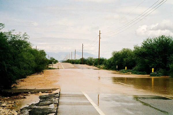
This project will provide downscaled, location-specific information about impending flash floods. The app to be developed will notify emergency responders in Larimer County, CO about the potential and estimated magnitude of a flash flooding event in real-time. They will in turn provide feedbacks via the app regarding the accuracy of the forecasts in regards to magnitude, location, depth of water, its movement, and will also be able to report the specific impacts they are witnessing with unprecedented accuracy in spatial resolution and time. For instance, a local report of vehicles being inundated at an intersection or low-water crossing is much different from a river that rises out of its banks and inundates nearby homes and businesses. The impacts from flash flooding warrant different responses from the emergency management community. In the case of flooded roadways and low-water crossings at night, motorists would be urged to simply stay at home. However, if a river overtops its banks and threatens a retirement home for instance, then first responders would consider evacuating them. These local reports will be integrated within FLASH in order to better predict specific impacts in the future as more and more reports populate the database.
Local emergency managers and first responders will be equipped with contemporary flash flood products, but simplified to be displayed via the app on their smartphones in real-time with updates provided every 10 min. This will improve their situational awareness leading to more actionable responses in a timely manner. The measurable impacts that will follow the successful demonstration of this project include reductions in losses to life and property.
For more information, visit the Flooded Locations and Simulated Hydrographs Project (FLASH) website.
Streaming Flash Flood Forecasts into the Hands of Emergency Managers: NOAA app crowdsources flooding data and turns tablets into emergency response tools. By Ben Young Landis
Descripción
Challenge
Flash flooding poses significant threats to lives, property, and daily routines in local communities in the state of Colorado. This was particularly apparent in September 2013 when flooding from extreme rainfall in the Front Range resulted in approximately $2 billion in damages and cost 8 people their lives. These devastating impacts can be mitigated by actions taken in the local communities prior to, during, and following these events. While local National Weather Service offices are responsible for monitoring conditions and providing warnings to the public and local communities about impending flash floods, these warnings are often covering large regions on the order of a city or even a county, and rarely provide details about the anticipated impacts or magnitudes of the anticipated flash flooding. Moreover, nearly half (46%) of the flash flood warnings issued by the NWS across the U.S. have no associated reports (i.e., they are false alarms), causing a possible diminished response by the local communities and the public at large. This is particularly concerning given that the U.S. population continues to urbanize, creating a society that is even more exposed to flash flooding. Second, climate change scenarios from numerous studies have indicated an acceleration of the hydrologic cycle in the future, causing more extreme rainfall events and subsequent flash floods.
Advances in computing and remote sensing have made it possible to forecast floods and flash floods. A grand challenge that remains with these forecast systems is the ability to estimate model parameters and flooding thresholds at local community scales, which are presently unresolvable by remote-sensing platforms. For example, flash flooding impacts are distinct from other meteorological natural hazards in that they are heavily influenced by local surface features, many of which are man-made. There can be houses at one end of the block that receive no impacts from flash flooding, while a storm drain that gets clogged by recently fallen leaves causes water to backup and enter homes just a few doors away. Often, these local “trouble spots” can only be identified by those who live and manage emergency situations in these communities.
Contact
Jonathan Gourley – Research Hydrometeorologist, NOAA/ National Severe Storms Laboratory
Zac Flaming – Cooperative Institute for Mesoscale Meteorology, University of Oklahoma
Michael Nguyen – Cooperative Institute for Mesoscale Meteorology, University of Oklahoma
Lori Hodges – Department Director, Larimer County Office of Emergency Management, Larimer County, Colorado
Collaborating Organizations
Thriving Earth Exchange (TEX) y Amazon Web Services (AWS) colaboran para utilizar la computación en la nube y las ciencias espaciales y de la Tierra con el fin de avanzar en las soluciones a los retos comunitarios relacionados con los recursos naturales, el cambio climático y los peligros naturales. Tras una convocatoria abierta de proyectos, se eligieron cuatro ganadores cuyos proyectos ejemplifican este objetivo. Cada prototipo se está trasladando a la plataforma de AWS, donde se pondrán a disposición del público para que otras comunidades puedan utilizarlos y ampliarlos. Más información.

Status:
Complete,
Location:
Colorado,
United States,
Managing Organizations:
Thriving Earth Exchange,
Project Categories:
Flooding,
Natural Hazards,
Natural Resources,
Project Tags:
No tags