
Integrating Sea Level Rise, Riverine and Flood Models
Marin County, California, United States
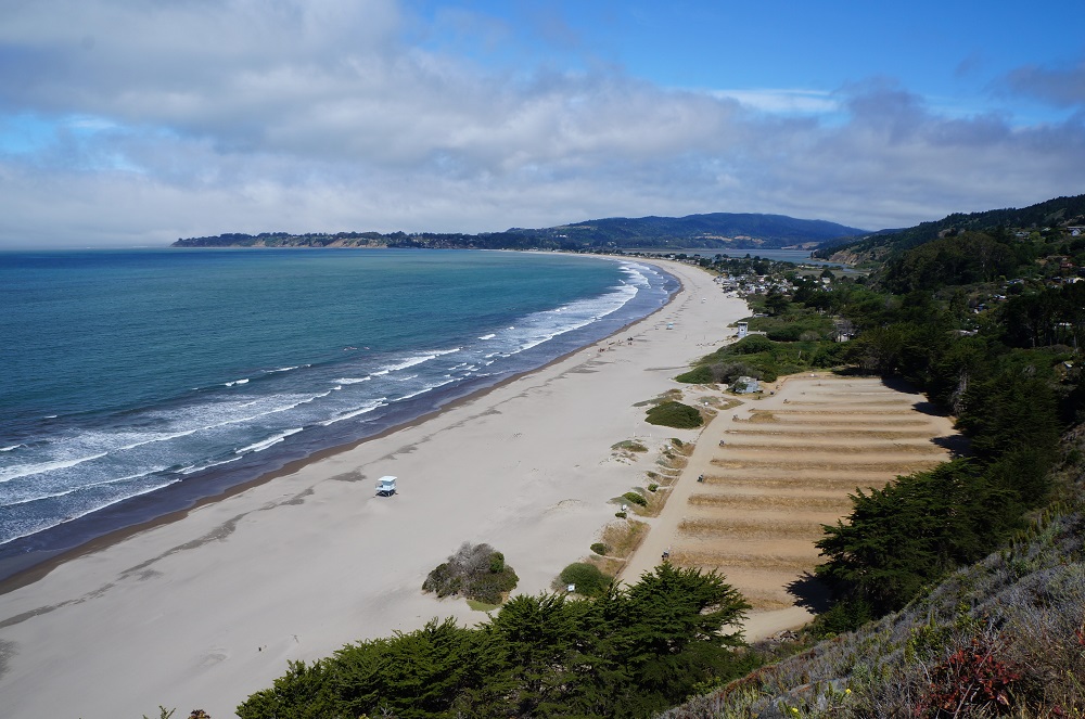
Photo courtesy of the Marin County Community Development Agency
Results
Phase II Results
Project Title: Compound coastal flooding assessment in Marin County
Location: Marin County, California
The Team:
- Jack Liebster, County of Marin Community Development Agency, [email protected]; 415 473-4331;
- Alex Westhoff, County of Marin Community Development Agency, [email protected], 415 473-7874
- Hamed Moftakhari, Assistant Professor, Department of Civil, Construction and Environmental Engineering, The University of Alabama, [email protected], https://eng.ua.edu/people/hmoftakhari/
The Initial Challenge:
 This project explored drivers of flooding on the west coast of Marin County, CA and explored whether there is significant interaction between these drivers that worsen flooding hazard in the county.
Compound flooding refers to the events where the coincidence of two (or more) flood drivers, which might be themselves at moderate, yield a significantly higher flooding hazard than each of these drivers would produce individually (in isolation). During such occasions, the nonlinear interactions of underlying mechanisms may significantly enhance the risk of flooding. Compound flooding has been studied and reported in many freshwater influenced systems, e.g. San Francisco Bay (Moftakhari et al., 2017). In these systems, several physical processes (i.e. atmospheric pressure variation) at different time-scales may interact to produce conditions resulting in compound flooding. The interactions between drivers in compound coastal flooding make accurate forecasting or analysis of compound flooding events difficult.
Prior to this collaboration, Marin County planners had significant concerns that compound flooding may occur in the areas subject to accelerating sea level rise. Such compound flooding could raise water levels higher than projected in existing model. If these increased water levels are not properly identified and integrated into vulnerability assessments and adaptation plans, it could be possible that adaptation measures would be constructed at an insufficient height, and thus fail at their purpose. Thus, planners in Marin County were faced with a question: How do you appropriately characterize – and respond to – this risk?
This project served as “Phase II” of Marin County’s exploration of compound flood hazards with scientists through Thriving Earth Exchange and involved the use of statistical analysis to characterize risk faced by the county. It builds on Phase I (summarized here), which served to explore and define Marin County’s questions and summarize potential approaches to identify high-risk sites.
The Methods
The western coast of Marin County is continuously threatened by direct oceanic surge tides (surge + astronomic tides) and precipitation-driven (pluvial/fluvial) flooding. This project performed a statistical analysis to test the hypothesis that there is a significant correlation between these two sources of flooding. The hypothesis was tested by analyzing the joint probability of:
- Water level observed at tide gauge located in Point Reyes, CA (NOAA Station ID: 9415020) and
- Hourly precipitation observed at the nearest rain gauge (Mount Tamalpais [GHCND:USC00045995]).
Each point had relatively complete time-series data available over a 38-year period. Hamed, the scientific partner on this project, used both the two-sided i) peak-over-threshold and ii) block-maxima sampling techniques (Wahl et al., 2015) to sample the data sets for different combinations of i) Surge tide and ii) Surge only from the coastal ocean water level, and i) hourly, ii) total 2-hour and iii) total 6-hour precipitation from the pluvial component, for a total combination of twelve scenarios.
The project team met for 1-hour conference calls every other month, on average. During working periods, collaborators spent approximately 1-2 hours per week contributing to the project.
The Results
The final product from this collaboration is a short report documenting the results of this statistical analysis. (Download here.) The analysis concluded that no significant correlation exists between coastal and terrestrial flood drivers in this system. Therefore, it would be valid for Marin County to assume that these flood drivers act independently from one another. This conclusion was also noted to be compatible with FEMA’s approach in flood risk mapping under compound flooding situations (FEMA, 2015).
Similar compound flooding conditions occur in many areas of the coastline. The analytical procedures employed in this case can provide a template for similar evaluations in these areas, allowing plans to incorporate vital information to make projections more accurate and to enable adaptation measures to be better fit to the actual conditions that will develop over time.
Reflections
The project team attributed several factors to the success of their project:
- A knowledgeable and enthusiastic scientific partner who is passionate about engaging the community
- The openness of Marin County officials to technical discussions and the insights they provided
- Organizational inputs and follow up from their Thriving Earth Exchange Coordinator
- Thriving Earth Exchange’s recruitment process, which led to pairing us with most appropriate scientist.
- Thriving Earth Exchange’s facilitation of calls and assistance with scoping the project.
- The key is really defining what the issue is and what the desired outcome is. The transfer of knowledge and experience with comparable projects in different parts of the county was valuable.
Despite their success, the project team noted several things they would do differently:
- Using the AGU Fall Meeting as an occasion for the first in-person meeting for the entire team. This could make the process more efficient.
- Engage in in-person site visits with scientific partner
- Conduct a comprehensive literature review in advance
They also shared advice for others pursuing similar community science projects:
- I’d say be prepared to LISTEN carefully. You will hear the real concerns of communities. These are not always among the top priorities of researchers.
- It’s good to attend AGU Fall Meeting in advance of starting a project. It’s a great opportunity to see results of past Thriving Earth Exchange projects, obtain a solid grasp of process, and network with other practitioners pursuing community science projects through Thriving Earth Exchange.
- It’s important to take meeting minute notes with action items. Send action items out after calls as a reminder.
- Don’t be afraid to ask your scientist for clarification on certain terms/concepts! Even if dense scientific discussion can be hard to follow by non-scientists, with effort it can be a valuable learning experience that can be transferred to community planning.
Phase I Results
Project Title: Integrating Sea Level Rise, Riverine and Flood Models
Location: Marin County, California
The Team:
- Alex Westhoff, Planner, Marin County Community Development Agency, [email protected], (415) 473-7874
- Jack Liebster, Planning Manager, Marin County Community Development Agency, [email protected]
- John Largier, Professor of Coastal Oceanography, University of California Davis, [email protected], (707) 875-1930
The Initial Challenge:
In projecting risk to coastal infrastructure, society and habitats, Marin County must account for flooding from both sea level rise (and tidal forces), as well as high river flow following a rain event. The highest water levels and greatest flooding will occur when high river flow coincides with maximum coastal water elevation. However, the probability of such an event – and associated flood levels – are not available for the county.
The Project
Marin County connected with TEX in late 2016 to connect with a scientist who could help them explore questions about addressing risk from combined coastal and riverine flooding. That December, County representatives travelled to San Francisco to participate in the inaugural TEX Project Launch Workshop at AGU Fall Meeting. The project they developed was launched in April 2017. It started with three goals:
- Review and identify gaps in existing models and data
- Determine how to integrate existing models to support future comprehensive flood risk evaluations
- Develop recommendations for potential next steps for Marin County
In the months that followed, the project team had regular conversations over the phone to discuss relevant regional initiatives, available methodologies, and possible approaches. In between these conversations, collaborators would review relevant documentation and reports. As part of this work, the project team met with the Adapting to Rising Tides Program of the San Francisco Bay Conservation and Development Commission (BCDC) to assess how their work might answer Marin County’s questions.
Ultimately it was concluded that the BCDC reports are valuable resources for the County to leverage, as they contain regionally-focused protocols applicable to Marin’s needs. Despite their value, however, the BCDC resources don’t fully address how to respond to risk from combined flooding events.
To conclude the exploratory phase of this project (“Phase I”), John Largier produced a memorandum that summarizes the background information, the state of the problem, and potential approaches for identification of high-risk sites (and their relative accuracy). In his assessment, the approach that will provide the best quantitative information (development of a coupled riverine and sea level model) will require the largest technical effort.
As a result of this collaboration to date, the problem and needs in the County are better defined and there is a better combined understanding of a path forward. Until Marin County (or BCDC) is able to dedicate the resources needed to develop a coupled flood model, the County would like to move forward with the application of a low-tech, non-resource intensive methodology to assess the degree of risk to certain watersheds to combined flood events. This will be pursued in a second phase for this project.
Reflections and Advice for Other Projects
- Regular, structured meetings are essential to maintain momentum in a project.
- Problem definition can be difficult. It’s important to recognize this and address as necessary.
- Be honest about your availability and capacity to contribute to a project.
- Reach out to known organizations in your field and/or area to share what you’re doing. It’s possible they may have ready-made tools or insights that could help your project.
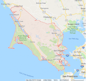
Description
Marin County, California is located north of San Francisco and home to approximately 250,000 residents. The county is resource rich: it is home to the Point Reyes National Seashore and Golden Gate National Recreation Area, as well as agricultural areas, beaches and numerous state parks. It is bordered by the Pacific Ocean, San Francisco Bay and San Pablo Bay on three sides and is thus vulnerable to flooding and sea level rise impacts. The county has been proactive and committed to responding to these challenges by providing flood risk and vulnerability information across county watersheds. This includes the BayWAVE and C-SMART initiatives, which facilitate evaluation of and response to sea level rise on the Bayside and Coastside of the county, respectively. This work extends to public engagement and education: Marin County’s “Game of Floods” won several prestigious honors, including the American Planning Association National Planning Achievement Award for Public Outreach in 2017
In projecting risk to coastal infrastructure, society and habitats, Marin County must account for flooding from both sea level rise (and tidal forces), as well as high river flow following a rain event. The highest water levels and greatest flooding (super-elevation) will occur when high river flow coincides with maximum coastal water elevation. However, the specific data on the probability of such an event – and associated flood extents – are not available for the county.
The Project
The County seeks to partner with a scientist to leverage existing models, resources, and assessments generated by the county, the San Francisco Bay Conservation and Development Commission (BCDC), and with TEX scientist John Largier of UC Davis. The goal of the collaboration will be to generate tabletop estimates to illustrate the increase in inundated area during such combined flooding events. Performing this exercise for one watershed in the county will enable the development of a replicable process that can be used in other areas, ultimately facilitating improved risk communication and updates to the county’s vulnerability assessment.
This represents Phase 2 for the Marin County-TEX project. During 2017, county employees consulted with John Largier, Professor in the Department of Environmental Science and Policy at University of California, Davis. Together, they analyzed the problem and the county’s needs. At the conclusion, John generated a memo summarizing the interactions at play and highlighting potential approaches for the county to identify at-risk locations.
While a work plan for Phase 2 will be developed in coordination with the scientist at the initiation of the collaboration, potential milestones for this phase of this project include:
- Review of existing resources, including linked reports,and Phase I outputs, and orientation to the status quo in Marin County
- Development of an approach or methodology to assess degree of risk to combined flood events given available resources (this need not be high-tech or resource intensive)
- Characterization of the probabilistic extent and duration of flood super-elevation taking into account the fluctuations of tide cycle heights and stream hydrographs that determine resultant combined water levels.
- Application of that approach or methodology on a key watershed in the county
- Review and communication of effectiveness and potential opportunities for improvement of the approach should greater resources become available.
Project Team
Community Leaders

Alex Westhoff is a planner with the Marin County Community Development Agency focused on adaptation planning for communities vulnerable to sea level rise. With more than thirteen years of experience in planning, monitoring and management activities for San Francisco Bay-Delta communities, professional interests include placemaking, preservation, public participation, and climate resiliency.
Holding a joint Master of City Planning/Mater of Landscape Architecture from UC Berkeley, his Master’s Thesis proposed designating the Sacramento-San Joaquin Delta as California’s first National Heritage Area which led to enabling congressional legislation, still currently pending. Prior to working for Marin County, he spent seven years with the Delta Protection Commission, focused on establishment of the Heritage Area and other projects to enhance the region’s sense of place. As a long term San Francisco resident, Alex enjoys all of the fascinating historical sites, cultural landscapes and natural beauty that the Bay Area has to offer.

Jack Liebster, Planning Manager, Marin County Community Development Agency
(Biography coming soon!)
Chris Choo, Principal Planner, Water Resources, Marin County Public Works
(Photo and biography coming soon!)
Scientific Partners
Hamed Moftakhari Rostamkhani is a Postdoctoral Scholar at The Center for Hydrometeorology and Remote Sensing at University of California, Irvine. He holds a PhD in Civil and Environmental Engineering from Portland State University (2015), a MSc in Civil Engineering-Water Resources from Sharif University of Technology (2010), and a BSc in Civil Engineering from Iran University of Science and Technology (2007).
His experience includes numerical hydrodynamic modeling of riverine/estuarine systems, developing analytical solutions for extreme water level prediction in tidal rivers, and hydraulic design of river structures for flood risk mitigation purposes. He has joined the FloodRISE team to develop a general framework for assessing inland/coastal flood risk from different drivers (i.e. precipitation, river flow, and oceanic tides/waves), and predicting future flood risk under climate change and human activities.
John Largier is Professor of Coastal Oceanography at the University of California Davis (UCD), resident at Bodega Marine Laboratory. Prior to 2004, he was Research Oceanographer at Scripps Institution of Oceanography. He has also held positions at the University of Cape Town and the National Research Institute for Oceanology (CSIR) in South Africa.
His research, teaching and public service is motivated by contemporary environmental issues and centered on the role of transport in ocean, bay, nearshore and estuarine waters. His work has addressed transport of plankton, larvae, contaminants, pathogens, heat, salt, nutrients, dissolved oxygen, and sediment – and he places this work in the context of issues as diverse as marine reserves, fisheries, mariculture, beach pollution, wastewater discharge, wildlife health, desalination, river plumes, coastal power plants, kelp forests, wetlands, marine mining, coastal zone management and impacts of coastal development. At UCD he heads the Coastal Oceanography Group. Dr Largier is a leader in developing the field of “environmental oceanography” through linking traditional oceanographic study to critical environmental issues. Following undergraduate studies in Maths and Physics, he obtained a Ph.D. in Oceanography from the University of Cape Town (South Africa) in 1987.
Media
Status:
Complete,
Location:
California,
Marin County,
United States,
Managing Organizations:
Thriving Earth Exchange,
Project Categories:
Climate Change,
Flooding,
Natural Hazards,
Project Tags:
No tags