
Assessing the Quality-of-Life Impacts of Municipal Assets, Resources, and Services in Montevallo, AL
Montevallo, Alabama, United States
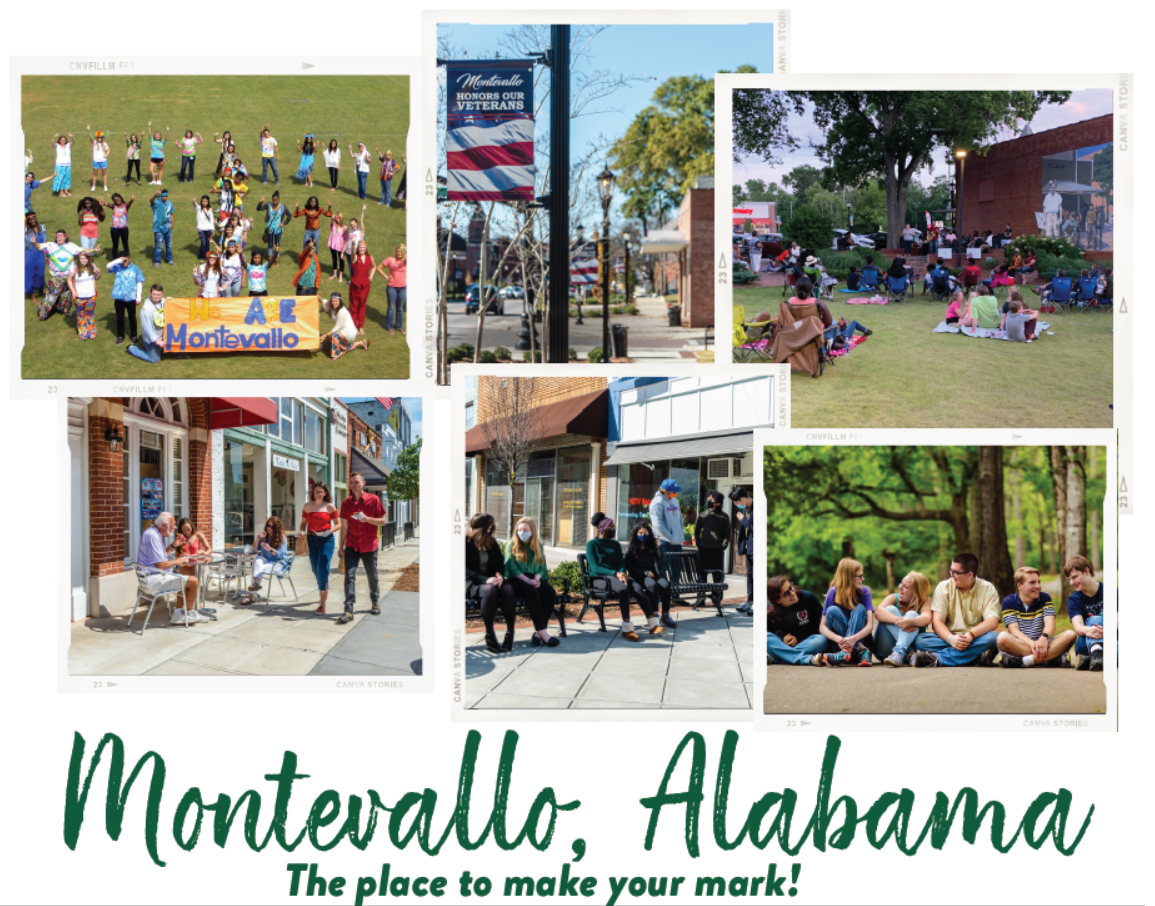
Image Courtesy of Montevallo AL
We aim to establish a Quality-of-Life Assessment (QOLA) and data collection process for our community. This assessment will determine the health impacts and financial benefits of community assets (safety, citizen engagement, etc.), resources (Montevallo Main Street organization, Arbor & Beautification Board, etc.) and services (park development, sidewalk maintenance, library programing, etc.)
Assessment results may lead to the creation of impactful programs and the allocation of funding to strategically address known or assessment-identified community needs. Future potential outcomes may include increased disposable income for residents, lower rates of violence, lower rates of substance abuse, and an increased sense of community.
Description
About the Community
The City of Montevallo, Alabama has been one of our state’s most diverse and progressive cities. The City of Montevallo’s total population is approximately 6,626 people. 15.1% of the population are under the age of 18 and 16.4% of citizens are over the age of 60. The City of Montevallo’s median income is $37,929 with 22.3% of the population living in poverty. 87.6% of Montevallo residents are high school graduates and 26.5% hold a bachelor’s degree or higher (US Census Bureau 2013-2017 American Community Survey Estimate).
We are a community which understands and appreciates how important it is to balance our need for progress with our need to preserve and protect that which gives Montevallo its uniqueness. Throughout our 200-year history, Montevallo has been a community which has continued to move forward and adapt to changes, without sacrificing its character or integrity. The City of Montevallo is constantly making strides to enhance the quality of life for all its residents through public improvement projects. These include Main Street sidewalk and streetscape investments, a designated Alabama Communities of Excellence Community, and establishing a local Main Street program.
Priority Question: How do we collect necessary evidence, and then use it to assess and communicate the Quality-of-Life of our community?
We aim to quantify the health impacts and financial benefits of community assets, resources, and services. Community assets are characteristics that influence Quality-of-Life such as safety. Community resources are provided to citizens through volunteer services and committees, while community services are provided to citizens through tax-payer funds. We think community resources directly impact community assets and consequentially our community’s Quality-of-Life. However, we don’t have a way to measure and assess this impact.
Our community does not have a Quality-of-Life Assessment, nor do we possess necessary data concerning the use or benefits of our community’s assets, resources, and services.
Relevant Resources
- Building a Quality of Life Index By Ryan M. Yonk, Josh T. Smith and Arthur R. Wardle
- Making Montevallo – Overview of Comprehensive Plan July 16, 2020 Planning Commission Public Hearing
- Montevallo pulls itself together to become a hangout and an Alabama Community of Excellence
- The Best Places to Live Methodology
- 2021’s Best States to Live in
The Project
This project will involve collecting data about our community’s assets, resources, and services with regards to Quality-of-Life and mapping their spatial accessibility. Once these data are collected, we would like our scientist to use it to create a public map for community members to use to find available resources in the city.
- Key Stakeholders:Other city boards (i.e., Arbor and Beautification Board or Main St. Board). This is variable as it depends on QOLA implementation and results.
- Target audience:Current and future City Council Members, the Mayor, and the entire community
- Primary Audience: Community (Interested in QOLA)
- Secondary Audience: City Council and Mayor (Interested in Financial Benefits)
Expected Outputs:
The scientist will create and deliver user-friendly public resource maps that will be used by community leaders over time. These maps will encourage the use of a variety of community assets, resources, and services including our recreational opportunities. This project will also involve a temporal component where community members can visualize how city resources change throughout the course of the year.
Expected Outcomes:
The resource mapping project can be used as a visual aid and evidence to inform city officials, city department heads, and community residents about the city assets that affect our community’s Quality of Life.
Expected Impact:
We will use the spatial and temporal resource maps for evidence to inform city officials’ decision making. Our work may lead to the creation of more impactful community programs and the allocation of funding to address specific community needs previously known or newly revealed. Skills and knowledge gained during this project will allow us to track changes regarding QOL and create benchmarks (e.g., 5 years goals). Our user friendly application may serve as inspiration for other communities who may benefit from developing their own QOLA. This project will benefit science by serving as a model for quantifying the health impacts and financial benefits of community assets, resources, and services in a small, southern, and rural community.
Timeline:
This project does not have a defined deadline; thus, its duration depends on the process that the scientist come up with. The new fiscal year (FY22) starts in October. If this project takes a year or slightly longer, the financial outcomes may be included in the FY22 budget. It is preferred to be included in the FY22 budget as opposed to the FY23 budget.
The project will begin as soon as a scientist is selected.
Project Team
Community Lead
Sarah Hogan earned a B.S. in Psychology and M.Ed. in Counseling at her beloved alma mater, the University of Montevallo in Montevallo, Alabama. During her tenure as a student, she developed a passion for the Montevallo community and is happy to call Montevallo her home. She has had the pleasure of working in the field of higher education, event management, local government, marketing, non-profit organization, counseling, and secondary education. She led the initiative to obtain the Main Street Alabama designation for the Montevallo community and currently serves as the Program Director of Impact Montevallo, a federal drug-free communities support grant program focused on reducing youth substance use. The experience and knowledge she has achieved throughout these positions has provided proficiencies in administrative operations, fiscal management, relationship cultivation, volunteer management, public relations and strategic organization. Amplifying her skills in communication, multi-tasking and collaboration. Sarah is an enthusiastic life-long learner, resiliently committed to excellence and devoted to contributing to the achievement of others.
Community Science Fellow
Shannon McAvoy (she/her) is a PhD student in Geospatial Analytics at North Carolina State University and she previously received her B.S. in Environmental Science from the University of Virginia. Her research is focused on creating equitable distributionsof forest ecosystem services and modelling landscape dynamics affected by climate change. Shannon currently works in awatershed ecology lab in the Forestry Department at NCSU and is interested in researching how forest cover and connectivity affect the social vulnerability of local communities. She views all of her work through an environmental justice lens and believes that community science is an integral part of all scientific discovery.
Scientist Wanted
The goal of this project is to create a resource mapping application specific to our community.
We seek a scientist to contribute toward three primary goals:
- Teach our project leaders how to collect data on our community’s assets (e.g., safety), resources (e.g., Arbor & Beautification Board), and services (e.g., library programing)
- Work with the community leaders to collaboratively create spatial and temporal maps based on the values, the impacts, and the benefits of our community’s assets, resources, and services
- Application should emphasize community access to resources and how they are related to Quality of Life
- A user-friendly interface should be developed to allow stakeholders to visualize community resources
- Assessment results will need to be translated into layman’s terms
Desired skills and qualifications:
- Experience using Geographic Information Systems (GIS)
- Experience with data collection and analysis
- Comfortable navigating politically tense conversations and focusing on areas of common ground. For example, any discussion of the anthropogenic impacts on the environment or Earth is best avoided
- Knowledge and respect for our Southern Culture
- Transdisciplinary Knowledge (Population science, municipal finances, etc.)
- Experience with community science and teaching the scientific method to non-scientists
- Strong listening and collaboration skills
- Community is open to working with students
*This is an unpaid, volunteer position, but Thriving Earth Exchange may provide limited support for project materials
Thriving Earth Exchange asks all scientific partners to work with the community to help define a project with concrete local impact to which they can contribute as pro-bono volunteers and collaborators. This work can also position the scientists and communities to seek additional funding, together, for the next stage.
Status:
Complete,
Location:
Alabama,
Montevallo,
United States,
Managing Organizations:
No organizations
Project Categories:
public health,
Project Tags:
No tags