
Creating community through neighborhood environment monitoring
New Orleans, Louisiana, United States
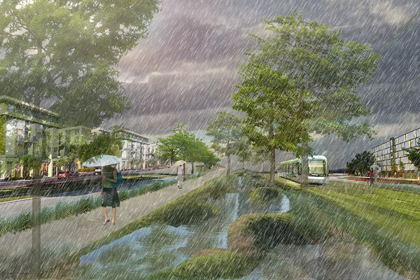
Image courtesy of Sustainia
Local organization ISeeChange worked with Thriving Earth Exchange to engage the Gentilly, New Orleans community in effective data collection and story sharing to inform flood infrastructure decision making – and build community connections through science.
Results
The Initial Challenge
Gentilly is a historic New Orleans district built on what was once the floodplains of Lake Pontchartrain. Most of Gentilly is below sea level with some areas as low as six feet. Even routine storms can cause major flooding there. The city is planning green infrastructure projects to alleviate flooding, but if the models show whole neighborhoods under water, where should they focus their efforts? Further, designers and modelers are working with data that could be outdated or lack crucial details, particularly granularity and community context. How do specific locations react to extreme rain events? How do you find out?
Methods
To answer these questions, the New Orleans ISeeChange-TEX project team designed and launched a community investigation that coupled citizen science with the stories of how community members were affected by flooding. The project, which coincided with the rainiest spring-summer on record in New Orleans, engaged residents and scientists to produce ground-truthed data (i.e. data produced by direct observation) and study the impacts of neighborhood flooding in a level of detail remote sensing and models cannot achieve.
![]() The community-led investigation was housed on the ISeeChange platform. There, residents reported observations, including detailed impacts of flooding, photographs, and precipitation totals, around their homes. ISeeChange also set up 15 flood comment boxes – with paper pop-up surveys – to recruit residents in the most flood prone neighborhoods. Within two weeks, the community reported over 158 trouble spots including several that hadn’t been previously identified. Participants also offered contact information and volunteered to help monitor flooding.
The community-led investigation was housed on the ISeeChange platform. There, residents reported observations, including detailed impacts of flooding, photographs, and precipitation totals, around their homes. ISeeChange also set up 15 flood comment boxes – with paper pop-up surveys – to recruit residents in the most flood prone neighborhoods. Within two weeks, the community reported over 158 trouble spots including several that hadn’t been previously identified. Participants also offered contact information and volunteered to help monitor flooding.
As flood posts were collected on ISeeChange’s platform, the project team analyzed the correlation between flood events and types of storms, and compared it to the city’s modeled data. The team partnered with one resident at a particularly flood-prone intersection to develop a community-sourced method to groundtruth the modeled flooding outside her home. A manual rain gauge and timelapse camera were used to document rain events and drainage rates in detail.
To complete this work, the team met bi-monthly, both in person and over the phone, to review the project objectives and develop methods. TEX project volunteers were local, able to spend time getting to know the ISeeChange team, and made site visits to the flooding hotspots to get detailed GPS measurements. In addition to the two team hydrologists, the ISeeChange team recruited and interviewed meteorologists from the National Weather Service , modelers from the Lower Mississippi River Forecast Center, water architects, and green infrastructure engineers to provide feedback on our methods, our data quality, and the value of our efforts.
Results
The output generated by this collaboration was a co-produced methodology which enables residents to help ground truth flood maps and provide granularity that’s valuable to modelers, engineers, designers, the City and the National Weather Service. The development of these methods in sync with the deployment of HUD-funded green infrastructure investments creates baselines of flooding per storm recurrence intervals, but also presents opportunities to evaluate the impacts of stormwater mitigation efforts later. Finally, the data collection method also has the unique ability to provide qualitative details of the lived experience at scales that are often missing from models and remote sensing data.
The TEX-ISeeChange team produced a hydrograph to communicate results and presented the work several times at the American Geophysical Fall Meeting in panels, workshops, presentations, and posters. Using a mix of journalism stories, live story events, pop-up block party exhibits, and street art interventions, the results of the effort were creatively shared back to the community detailing the results.
Ultimately, the team found that the modeled flood data doesn’t adequately capture the severity of the impacts at flooding hotspots, nor does it reflect the amount of traffic that passes through the intersection. The failure of modeled data to provide the needed granularity to target solutions extends to the wider community as well. Like Gentilly residents, many New Orleans residents experience flooding during average storm events, and many streets take minutes to flood, but hours to drain.
This project has implications for scientists, planners, residents, and the City itself. The project demonstrated that scientists can directly partner with residents and external collaborators to co-develop research that is responsive to community needs and doesn’t sacrifice data quality. This project also demonstrated the effectiveness of a new methodology for engaging community members in highly contextualized observation and micro-data collection. The collection of this baseline data provides previously unavailable clarity and direction for planning agencies planning to make large investments in the neighborhood. Now, green infrastructure designers can better target solutions, as well as evaluate the impacts of stormwater projects.
Through engaging in this initiative, residents became more informed about flood risk while documenting storms – this was evident in language and data references used in posts on the ISeeChange platform.
Recognizing the value of ground truth data alongside the education and outreach value of the effort, the city has asked ISeeChange to distribute 300 rain gauges throughout New Orleans to scale out this method.
Next Steps
The success of the project has led the ISeeChange team to invest in new flood monitoring tool development on their platform, allowing the method to scale to new communities.
This work was time intensive. The team is now considering how can they scale up the initiative without sacrificing quality.
The relationship between ISeeChange and the Tulane Bywater Institute has strengthened on multiple fronts and the groups would welcome additional opportunities to collaborate again on local resilience projects in the City of New Orleans or on the Gulf Coast.
Reflections
Things that contributed to success of the project:
- Experienced team members open to collaborating with residents and developing new methods
- Proximity allowed the entire team to meet frequently and visit project area–especially helpful in developing something new
- We picked a record breaking year to focus on flooding
Things the team might do differently if they were to do it over again:
- We would have interviewed users of our data earlier in the process
- We would have asked residents to report “non-flooding” events as well as flooding events
Advice for people pursuing similar community science projects:
- Continue experimenting and talking to people until you land on the right methods for what you are hoping to achieve. Don’t settle for data collection–target a decision you want the data and the effort to help support.
- Engage with community residents early in the process to assess volunteer availability and capabilities, which provides valuable input for developing practical limits on data collection methods.
Read More:
New Orleans Flooding Case Study (Presented at 2017 AGU Fall Meeting)
May 2018 Feature in PhysicsWorld (Video)
Description
Project Timeline
This project took place from May 1, 2017 – December 1, 2017. However, ISeeChange continued to conduct monitoring activities after the project period, ended to further inform flood infrastructure decisions in the community.
Project Summary
Gentilly is a historic New Orleans district built on what was once the floodplains of Lake Pontchartrain. Most of Gentilly is below sea level, by as much as six feet in some areas. Even routine storms can cause major flooding in the district.
The city is planning green infrastructure projects (like planting gardens and restoring natural waterfront areas) to alleviate flooding, but if the models show whole neighborhoods under water, where should they focus their efforts? How do specific locations react to extreme rain events?
Local organization ISeeChange worked with Thriving Earth Exchange researchers to design a community investigation that coupled citizen science with the stories of how community members were affected by flooding. The project engaged residents and scientists to produce data produced by direct observation, enabling them to study the impacts of neighborhood flooding at a level of detail that remote sensing and models can’t reach.
The project coincided with the rainiest spring and summer on record in New Orleans and found that modeled flood data didn’t capture the severity of the impact at flooding hotspots in the community or the impact it had on people’s movement through the community.
In combination with rain gauges and field cameras, this first-hand data gave city planners crucial information and a place to start for implementing new, community-led, climate-friendly strategies to control flooding in the district.
This included building a water garden, butterfly garden, and improved access to Gentilly’s waterfront as part of an integrated flood management system that includes green infrastructure.
Approach
ISeeChange’s mission is to connect communities to each other and their changing environment, and they provide engagement tools for communities to empower participants with their own stories and data to investigate the impacts of climate change. The organization launched a neighborhood pilot program in the Gentilly Resilience District in New Orleans to further the climate resilience and creative placemaking efforts of the Trust for Public Land, the City of New Orleans, and other resilience partners.
The flood and subsidence investigation in the Gentilly Resilience District of New Orleans informed plans for green and blue infrastructure projects to manage stormwater in the community under a multi-million dollar grant from the U.S. Department of Housing and Urban Development. This neighborhood investigation was a citizen science effort and included residents documenting their personal experiences alongside collected data (weather, temperature, etc.).
ISeeChange developed multidisciplinary project team to advise on, co-design and implement the project, including ISeeChange staff, scientific experts (e.g. subsidence and urban meteorology), local journalists and community members.
Scientists Brendan Yuill and Brendan Edwards, who engaged on this project through the Thriving Earth Exchange, collaborated with ISeeChange cofounder Julia Drapkin to inform the investigation design and contribute to the analysis of collected data and observations. Their input ensured that the information collected through this effort was actionable, scientifically valid and useful. (For another example of an ISeeChange community investigation, see their Harlem Heat project.)
As a direct result of this project, the development and analysis of the ISeeChange Gentilly Resilience District pilot project was informed by a scientific understanding of the community’s hydrology.
The ISeeChange Gentilly Resilience District pilot project facilitated the community’s participation in collecting baseline data needed to finalize and implement green and blue infrastructure designs in New Orleans, and integrated their personal experiences into the process. This not only yielded crucial observational data that flood modeling, for example, could not provide – it helped community members affected by local flooding become more connected to each other and their environment.
Project Team
Community Lead

Julia Kumari Drapkin is the executive producer and founder of iSeeChange.org. She is a radio, television, and multimedia producer based in New Orleans with a passion for finding innovative ways to connect people to their environment and to each other. iSeeChange was born out of covering natural disasters and climate change science across the globe and in her own backyard. Drapkin has worked as the Senior Science Reporter for The Nature Conservancy; a foreign correspondent and environmental radio reporter for PRI’s The World and Global Post in South America; as a photojournalist for the Associated Press in South Asia and the St. Petersburg Times; and most recently as a multimedia producer for the Times Picayune.
Scientific Partners
Brandon Edwards’ background is in coastal, aeolian and floodplain geomorphology, coastal and wetland hydrology, and remote sensing. His research focuses on studying geomorphic and hydrologic processes to better understand landscape development, the role of physical processes in ecosystem function, and how natural and anthropogenic modifications drive change. Brandon has been with the School of Renewable Natural Resources at the Louisiana State University Agricultural Center since 2011 and is currently on contract as a Coastal Geomorphologist with the U.S. Army Corps of Engineers Environmental Lab working on projects to improve coastal restoration strategies.
Brendan Yuill is a research scientist with the non-profit, the Water Institute of the Gulf. His research interests span engineering geomorphology and watershed hydrology using both field-based and numerical methods. Recently, he has worked on projects relating to coastal restoration along the Gulf Coast with focus on land building sediment diversions and managing the impact of sand dredging on rivers. He is particularly interested in developing novel data streams useful for long-term, low-cost environmental monitoring. Brendan holds an adjunct position at Tulane University and received his PhD in watershed management and ecohydrology at the University of Arizona.
Collaborating Organizations
![]()
Status:
Complete,
Location:
Louisiana,
New Orleans,
United States,
Managing Organizations:
Thriving Earth Exchange,
Project Categories:
Climate Change,
Project Tags:
No tags