
Analyzing upstream inputs to Ore Lake and assessing wetland restoration options for regional flood mitigation
Michigan, Ore Lake,
Results
Description
The Challenge
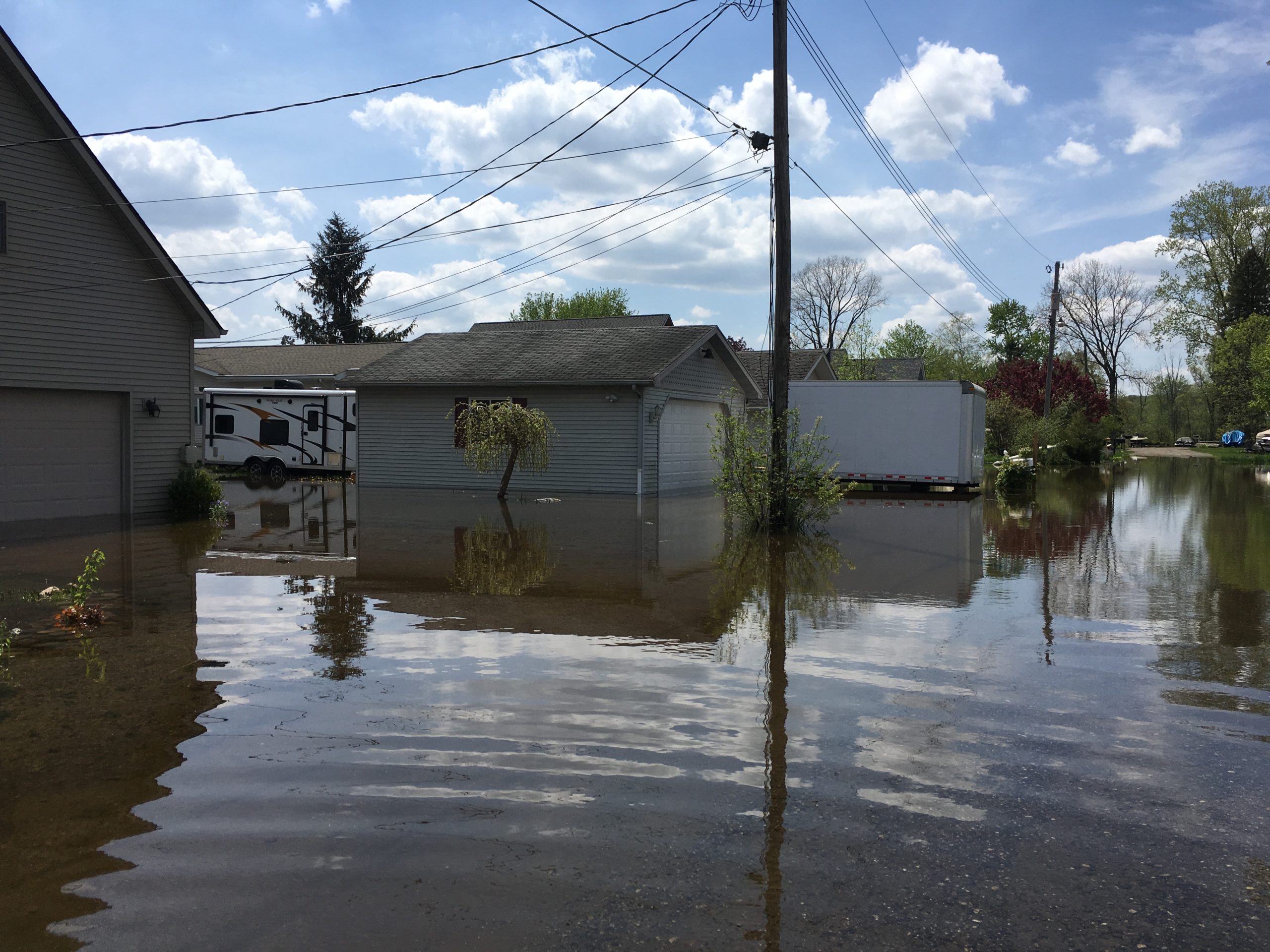
The community consists of residents along Ore Lake and the Huron River. Ore Lake is a spring-fed, inland lake that flows into the Huron River, which is a tributary of Lake Erie. The community is interested in collaboratively responding to the increased flooding in the region that affects most residents on the lake and along the Huron River, downstream of Ore Lake.
The community has been dealing with flooding issues for many years with the frequency of floods increasing in recent years. For example, 8 of the top 10 historic crests occurred in the past 16 years with multiple flooding events occurring each year for the past three years.
Hamburg Township, the local township, has responded to the flooding by implementing interventions to increase downstream water flows and funding studies to assess options to reduce damages from flooding events. Specifically, the township has increased downstream water flows by cleaning out and removing weeds from the Huron River south of Ore Lake. However, despite this intervention, the flooding in the region continues to increase, which means further flood mitigation efforts are needed. In particular, there have been 20 flooding events since the onset of weed removal from the Huron River in 2005 with recent years having multiple flooding events. Prior to the weed removal, there was, on average, one flooding event each year.
Recently, Hamburg Township funded a study completed by the US Army Corps of Engineers and the US Geological Survey on the inputs and effects of flooding on Ore Lake and downstream. This study was useful in identifying ways to reduce financial damages from a given level of flooding (e.g. identifying structures that need to be raised), but the study did not provide information on upstream water inputs driving flooding events or suggest larger interventions to minimize flooding.
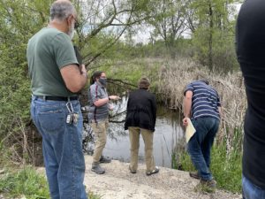
The community is interested in pursuing upstream interventions, such as wetland restoration and/or protection, to prevent or minimize regional flooding. However, the community lacks information about upstream inputs to Ore Lake and the Huron River, which are essential for (1) assessing whether wetland restoration and/or protection efforts could mitigate regional flooding, (2) targeting where wetland restoration and/or protection efforts would be most beneficial in helping retain water during large rain events, and (3) developing grant applications to fund wetland restoration and/or protection projects.
The Project
Community leaders have identified several objectives for a Thriving Earth Exchange project to address flooding in their community:
- Collect and analyze data on upstream water inputs to Ore Lake and the Huron River. Community leaders and local government officials currently have very limited access to data on where water flowing into Ore Lake is coming from, and this lack of data is a key barrier in assessing upstream flood mitigation options. In order to meet this objective, scientists and community leaders will work collaboratively to develop a plan for collecting new streamflow data (e.g. decide where to make measurements and determine how long an observational record is necessary) and/or to identify and synthesize existing hydrologic datasets to estimate upstream water inputs. The upstream water input data would be shared with community leaders and planning officials
- Use the information about upstream water inputs to assess the extent to which wetland restoration and/or protection upstream could mitigate flooding, and to present these findings to local community members, government officials, and nonprofits.
- Target where wetland restoration and/or protection efforts would be most beneficial in helping retain water during large rain events. The third objective will be contingent on the results of objective 2.
- Identify available and applicable grants and other funding sources which could be used to fund wetland restoration and/or protection efforts
- Collaborate with community leaders to write proposals for funding
If necessary due to time/resource constraints, the second, third, fourth, and fifth objectives may be reserved for a phase 2 project.
As a result of this project, the Ore Lake community and greater Green Oak and Hamburg Townships will gain a better understanding of possible upstream interventions available to mitigate flooding risks in their community. This information will help the community better target future flood mitigation efforts, and provide data needed to acquire funding for flood mitigation planning.
Timeline
The collaboration between the community and the selected scientific partners should begin as soon as possible. The project should take approximately 12 months, and it will consist of four phases:
- collecting new data and/or compiling existing data to quantify upstream water inputs to Ore Lake – targeting objective 1
- analyzing upstream water inputs to Ore Lake – targeting objective 1
- conducting a feasibility study of possible wetland restoration options to mitigate flooding targeting objectives 2 and 3
- identifying possible funding sources and collaborating with community leaders to write proposals for funding – targeting objectives 4 and 5
Project Team
Community Leaders
 Dr. Amber S. Bismack is an Assistant Professor of Science Education and the founder of the organization, Residents Working Against Huron River Flooding. As a resident in the Huron River watershed, she experienced multiple floods including two that forced her and her family to leave their home. The organization, Residents Working Against Huron River Flooding brings together neighbors, community members, local government, and environmental organizations to work together to address the flooding issues along the Huron River. Amber serves on the Hamburg Township Flood Prevention Committee and the Huron River Watershed Council Board of Directors. Her extensive experience communicating and researching science in schools and communities allows her to be a vocal leader and educator of the needs of environmental reform in a continually flooding community.
Diane Henry
(Bio coming soon)
Community Scientists
Dr. Wendy Robertson, Associate Professor, Central Michigan University
(Bio coming soon)
Scott Dierks, PE, Senior Water Resources Engineer, GEI Consultants
(Bio coming soon)
Community Science Fellow

Claire Zarakas is an Atmospheric Sciences PhD student and DOE Computational Science Graduate Fellow in the Ecoclimate Lab at the University of Washington. Her research broadly focuses on interactions between terrestrial ecosystems, land use, and climate. She is also interested in climate policy and environmental justice, and she is committed to promoting diversity, equity, and inclusion in STEM. Prior to joining the Ecoclimate Lab, she worked at a public sector consulting firm where she conducted research to inform climate mitigation and adaptation policies. She graduated from Princeton University in 2016, where she was a NOAA Hollings Scholar and Geosciences major.
Collaborating Organizations
This project is supported by funding from the Gordon and Betty Moore Foundation.
![]()
Status:
Complete,
Location:
Michigan,
Ore Lake,
Managing Organizations:
No organizations
Project Categories:
Flooding,
Natural Hazards,
Natural Resources,
Project Tags:
No tags