
An International Collaboration to Save Forests in El Salvador
Local farmers turn to remote sensing and sustainable agriculture to reverse years of damage to primary growth forests
by Kathleen Pierce
Tropical rainforests help maintain the balance of carbon in the atmosphere, contain immense biodiversity, and are essential to the lives of the people who live near them. Yet around the world, more than 5,000,000 hectares of these forests are being lost or degraded each year.
This is the story of how one small farming community in El Salvador is fighting back.
The Problem
The forest is integral to life in La Mancomunidad La Montañona, a rural area in the mountainous Chalatenango region of northern El Salvador. The trees filter the water from the rain, rivers, and streams that are the only local water source, protect against soil erosion in the heavily sloped area, and support rich ecosystems. The forest also has global importance – the trees remove carbon from the air, helping to mitigate climate change.
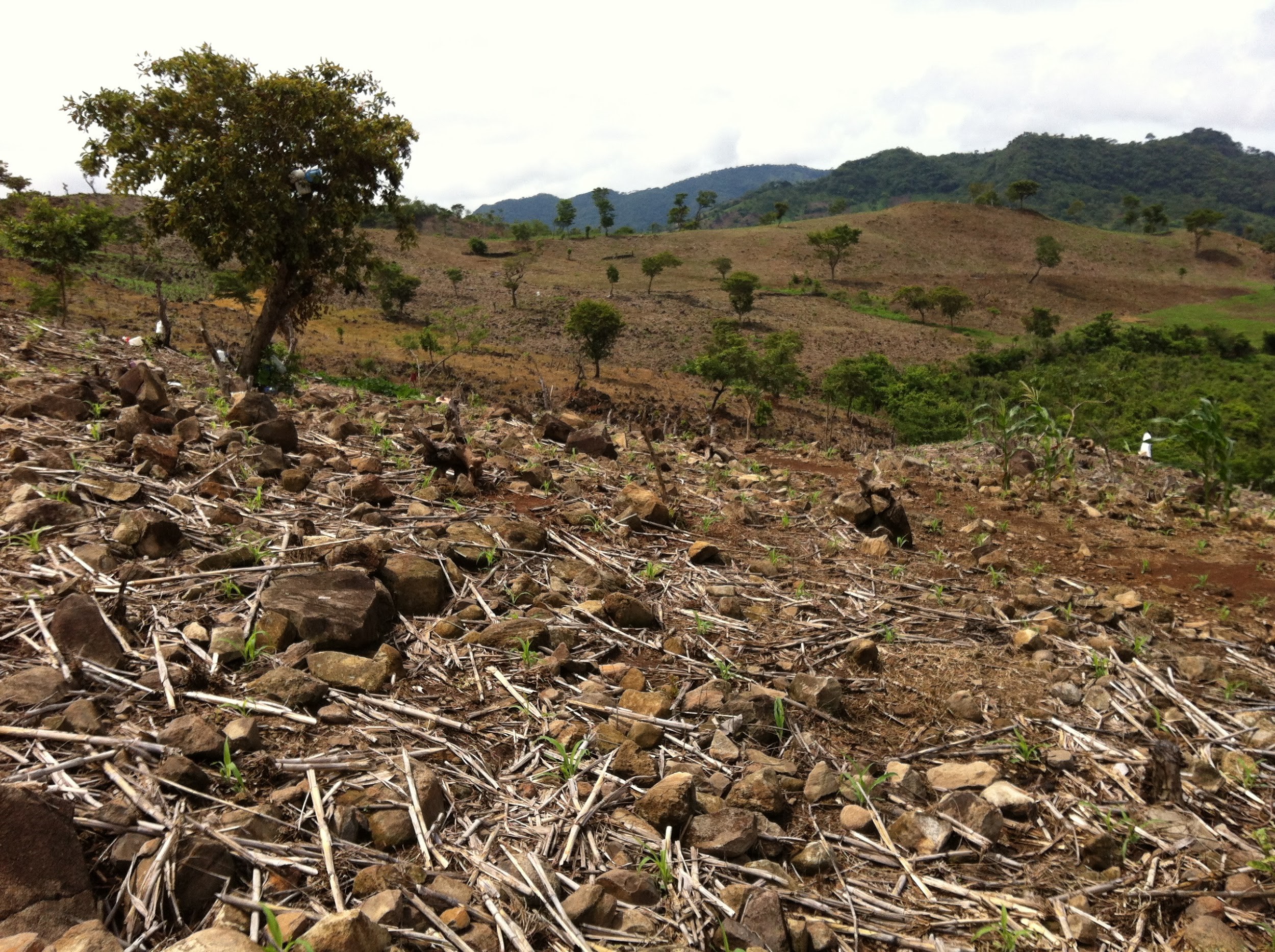
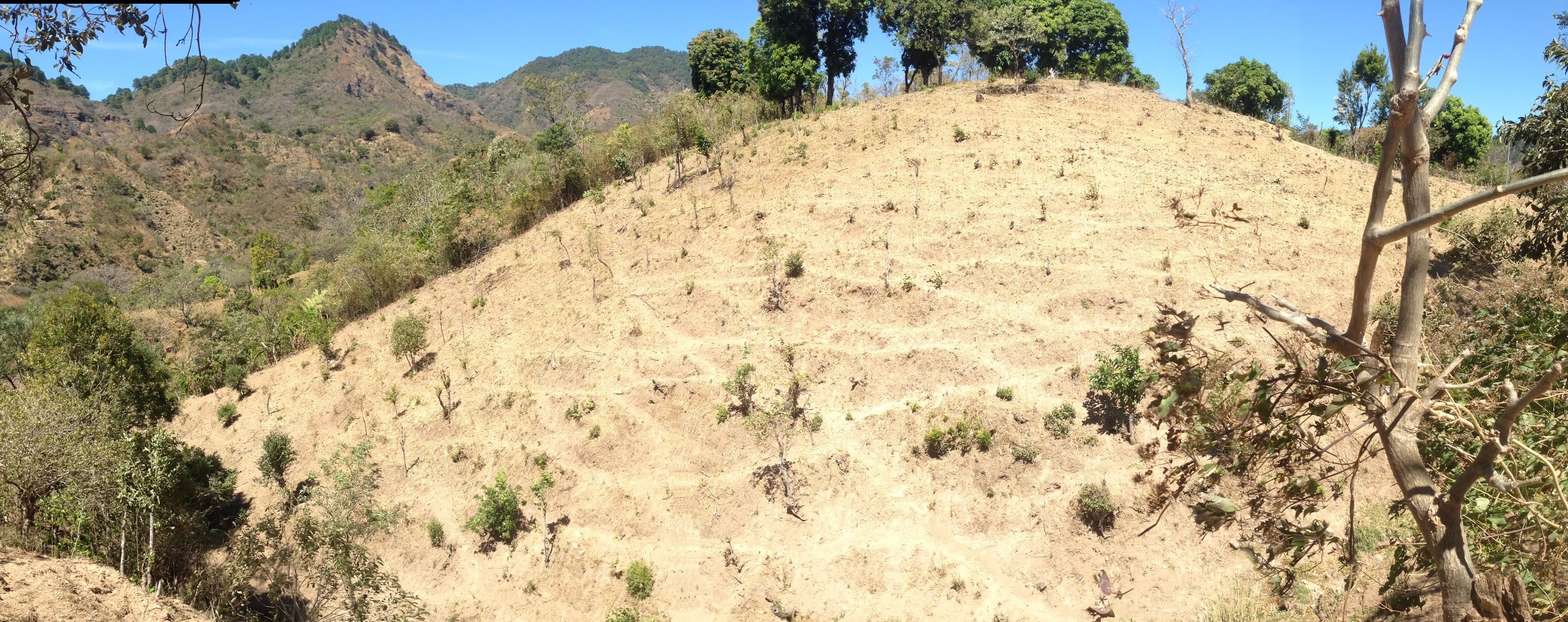
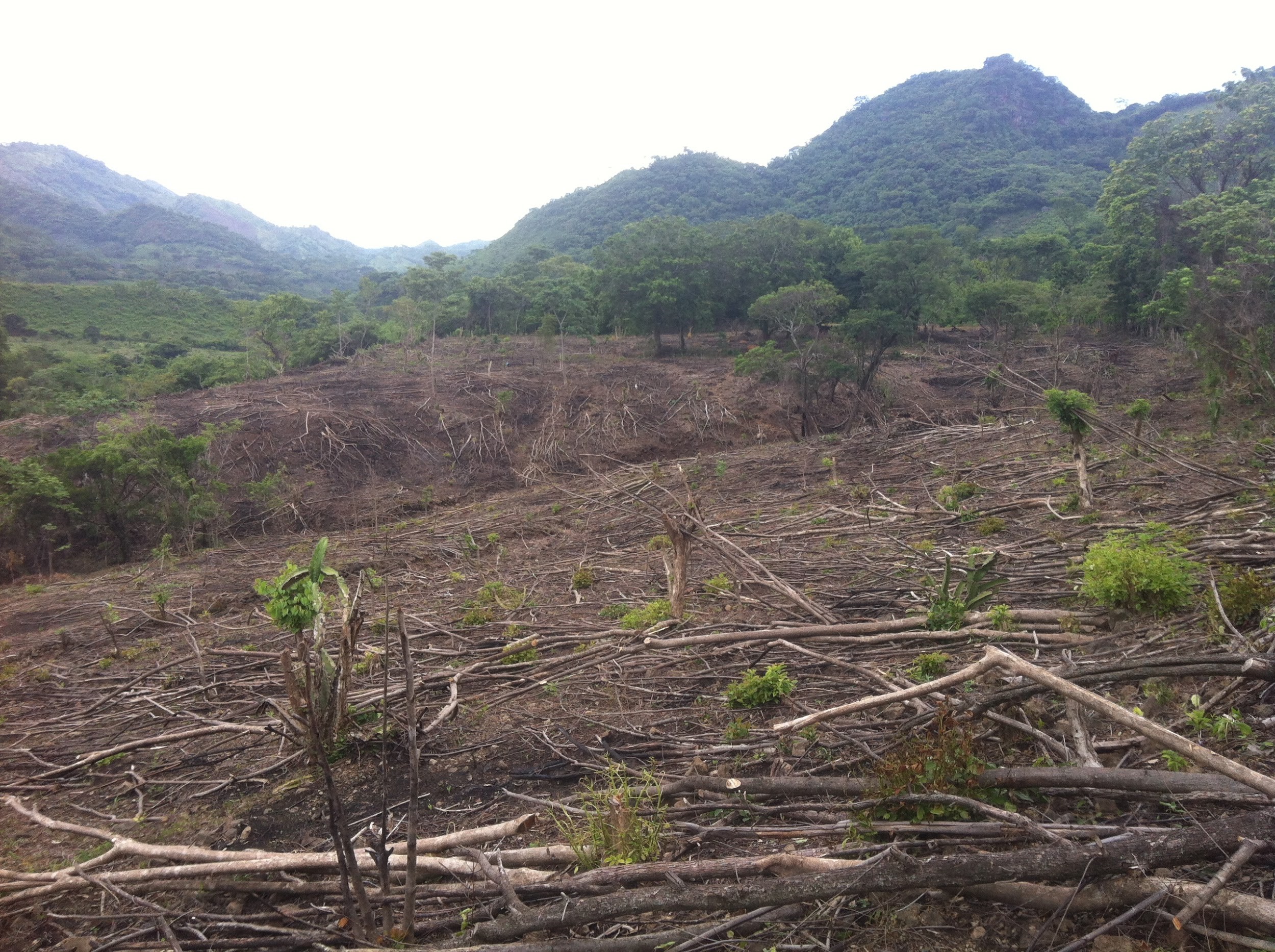
But over many decades, a number of factors have combined to create untenable amounts of deforestation in Chalatenango. With limited money and resources, local communities regularly cut down trees for fuel. Large patches of forest were cleared using the slash-and-burn method to create pastures or grow subsistence crops such as corn, beans and rice. On top of everything, the country’s violent civil war in the 1980s and early 1990s drove people to flee the region and further disrupted the landscape.
After the war ended in 1992, people slowly returned to La Mancomunidad La Montañona, but the forest had changed. Primary growth trees (mostly pine and oak) had been heavily damaged in the war, and secondary growth trees were young and fragile. In order to rebuild their way of life, ranchers needed pastures and farmers needed fields, but it was clear that the forest couldn’t sustain more damage. A new solution was needed that would allow the people and the forest to flourish.
The Project
Locals weren’t the only ones worried about Chalatenango’s forests. The region’s alarming level of deforestation was evident from remote sensing and GIS data, and El Salvador’s Ministry of the Environment and Natural Resources (MARN) identified La Mancomunidad La Montañona as a priority area for forest conservation. MARN tapped both local and international groups to create a problem-solving superteam.
The collaboration included the Agroforestry for Biodiversity and Ecosystem Services (ABES) project, a partnership between the Earth Institute at Columbia University, the International Center for Tropical Agriculture (CIAT) and the Salvadoran Program of Research on Development and Environment (PRIMSA), which both studied El Salvador’s GIS data and conducted their own surveys assessing forest health and biodiversity; the United States Agency for International Development (USAID), which offered funding and expertise in developing and promoting sustainable agricultural practices; and NASA DEVELOP, a NASA initiative that applies Earth observations to address community concerns around the world.
The team used MARN and NASA’s satellite mapping resources to create a historical Land Use/Land Cover (LULC) map of the forest from 1986-2014, refining it using plot data and high-resolution imagery to create the most accurate “ground truth”—a reconciliation of satellite imagery and direct ground observation. The LULC map also identified the areas of the forest most at risk, such as those located on extremely sloped areas, close to roads, in the younger secondary growth areas, or on the immediate edges of primary growth forests. Such information can be used to predict—and, ideally, prevent—future deforestation.
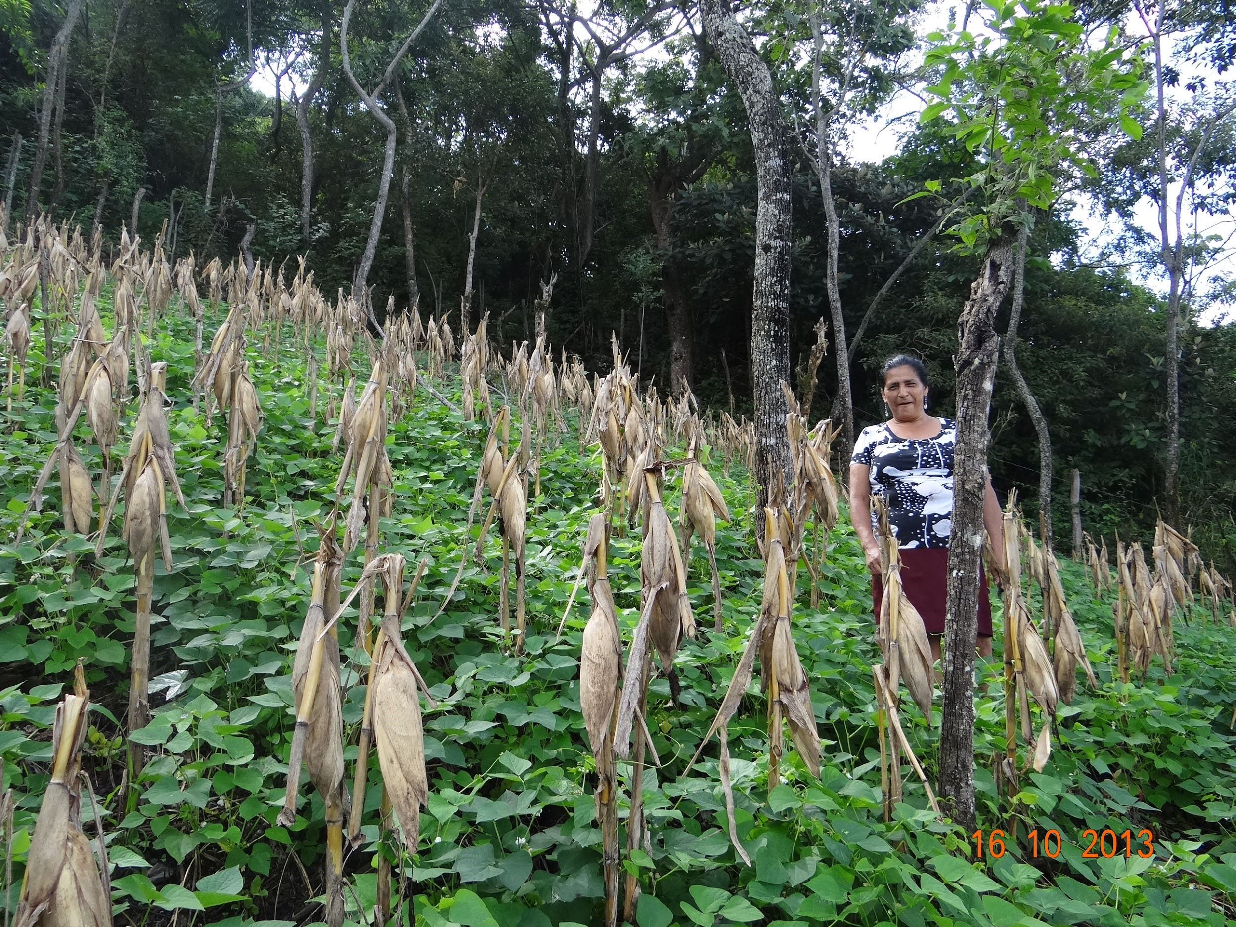
While outside expertise can go a long way, the people who use the forests every day are key to the project’s effectiveness. A local NGO, PRISMA, coordinated workshops in which the local stakeholders—ranchers, farmers, mayors and other officials—not only discussed the problems but also made key decisions. For example, these groups advised on what types of trees should be planted to restore degraded fields.
“Building relationships with local stakeholders was an ongoing process,” said Sean Kearney, the ABES coordinator. “This was a great opportunity for farmers to learn from each other and really take ownership of some of the innovations that came directly from them.”
The LULC map is one tool to prevent further deforestation. Another is new agricultural methods: Slash-and-burn is no longer sanctioned, and USAID invested more than $1 million in research and training for technicians in research methodologies, and farmers and local officials in more sustainable agricultural practices. The officials then passed that learning on to other local farmers and ranchers; all told, more than 500 farmers and ranchers from the region participated in the project.
The Payoff
La Mancomunidad La Montañona now has powerful tools at its disposal as it fights to protect its forests, and is hoping to expand the project further. While government agencies and international researchers facilitated the project, the true learning and growth came from within the community, who were able to influence the project’s direction based on their needs. For example, considerations around potential water contamination and improved pasture grasses were included in the project at locals’ behest.
The experience can also benefit the country as a whole and inform future efforts in other regions. “The local community is very concerned about the forest quality, and MARN is interested in the broader health of the forestry in all of El Salvador,” said Jordan Ped, NASA DEVELOP team leader. “The project gives both MARN and La Mancomunidad La Montañona a place to focus their conservation efforts on.”
Kathleen Pierce is a contributing writer for Creative Science Writing and the Thriving Earth Exchange.