Apply now to join our next cohort of Community Science Fellows and Community Leads!
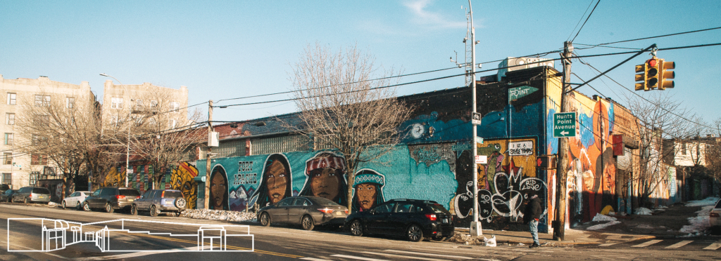
Hunts Point Community in the Bronx, NY is concerned about vulnerable and at-risk populations to heat-related health issues and identifying additional sources of heat that can be mitigated due to a lack of public green space and large health concerns due to elevated cases of asthma and cardiovascular illness. The projections show a significant increase in the number of dangerously hot days and longer and more frequent heatwaves in the coming decades – underscoring the need to address heat and potential impacts to public health. Extreme heat events disproportionately affect vulnerable populations i.e. low-income households, children and the elderly. Hunts Point would like to identify heat islands throughout the community and address priority areas for improvements to the built environment (i.e. tree plantings and cooling stations for).
This project will create heat vulnerability maps that identify hotspots and potential sources within the Hunts Point community. The analysis will integrate land use/land cover, air temperature, land surface temperature, and demographic data into an extreme heat vulnerability map. These maps will be hosted in an online dashboard on THE POINT’s website and shared with the community through various activities (forums, workshops, print maps, art installations, etc.). This project will also have a core community engagement strategy that involves local youth along with a citizen science component to increase community preparedness and climate-health education as well as social cohesion.
The heat vulnerability maps will be used to improve public awareness of extreme heat risks to minimize heat stroke and heat-related deaths, improve resiliency within the community to respond to extreme heat, identify target areas for mitigation activities, and drive potential policy changes in the future.
Hunts Point is an environmental justice community in the South Bronx and forms part of the South Bronx Significant Maritime Industrial Area (SMIA). Hunts Point is 695 acres on a peninsula bordered by the Bronx River and East River and is zoned for industrial and residential purposes. A large defining characteristic is the billion-dollar industry Hunts Point Food Distribution Center, which fills about 1/3 of Hunts Point area and most of the coastline in a community with food security and inequitable waste handling issues. It has a population of 54,000 people (76% Hispanic, 22% Black) with 36% having limited English proficiency and 43% living below the poverty line. Some of the community’s concerns are low quality & availability of housing, limited transportation, poor air quality, high unemployment, and education access.
By Kelly McCarthy and Zack Valdez
Community leaders and scientists from two U.S. cities are combining public health data and heat maps to prepare residents for climate change–related health risks.
As the global community celebrates World Health Day on 7 April, at AGU we want to highlight projects in two U.S. cities striving to make climate-related health information accessible at a local scale. Confronted with increased health risks to humans resulting from climate change, leaders within these communities are developing tools at the grassroots level to inform city planning, address needs for services, and identify areas for green infrastructure and cooling interventions.
Like many health threats, climate change is expected to disproportionately affect vulnerable populations, such as the elderly, young children, families living in poverty, and people with chronic diseases. From small rural cities to densely populated metropolitan centers, communities are developing resiliency efforts to ameliorate these escalating threats and inform local decision-makers.
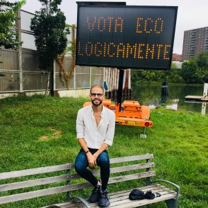 Fernando Ortiz is the Climate Preparedness and Resiliency Organizer at The Point Community Development Corporation (https://thepoint.org/), a non-profit organization dedicated to youth development and the cultural and economic revitalization of the Hunts Point section of the South Bronx. His work involves managing the Be A Buddy program, which is a pilot project in partnership with the NYC Department of Health and Mental Hygiene (DOHMH) and the Mayor’s Office of Recovery and Resiliency (ORR) around building social resilience and climate health education, particularly for those most vulnerable to extreme weather events. Ortiz currently holds a Masters in Sustainable Design and is completely a Masters in Sustainability Management at Columbia University.
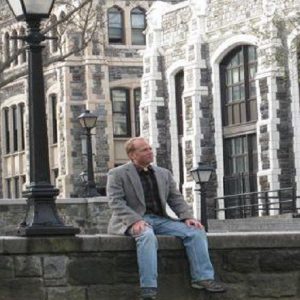
Brian Vant-Hull has a MA in Physics from Johns Hopkins and a PhD in Atmospheric Science from the University of MD, specializing in remote sensing. He has been a research scientist at City College’s CREST institute since 2007. His recent research has involved mapping the daytime urban heat island of Manhattan as part of the Consortium for Climate Risk in the Urban Northeast, and the relationship between indoor and outdoor heat waves as part of the Harlem Heat Project. He is currently involved in a project to investigate indoor air quality in Harlem’s Grant Houses. The Hunt’s Point Heat Monitoring project fits naturally into this body of work.
Julia Kumari Drapkin is the executive producer and founder of iSeeChange.org. She is a radio, television, and multimedia producer based in New Orleans with a passion for finding innovative ways to connect people to their environment and to each other. iSeeChange was born out of covering natural disasters and climate change science across the globe and in her own backyard. Drapkin has worked as the Senior Science Reporter for The Nature Conservancy; a foreign correspondent and environmental radio reporter for PRI’s The World and Global Post in South America; as a photojournalist for the Associated Press in South Asia and the St. Petersburg Times; and most recently as a multimedia producer for the Times Picayune.
ISeeChange is dedicated to empowering communities to document and understand their environment, weather and climate in order to increase resilience. ISeeChange mobilizes communities to share stories and micro-data about climate impacts to inform and improve climate adaptation and infrastructure design. Their platform, tools, and investigations provide equitable, iterative ways for residents to personalize, measure, and track climate change impacts and better participate in community adaptation decisions.
Each post is synced with weather and climate data and broadcast to the community to investigate bigger picture climate trends. Over time, community members can track how climate is changing, season to season, year to year, and understand the impacts on daily life.
ISeeChange is a strategic partner of Thriving Earth Exchange as community members use their platform and tools to better characterize, visualize, and communicate neighborhood-level climate trends and co-develop solutions to mitigate those risks.
(c) 2024 Thriving Earth Exchange