
Evaluating Ordinances and Policies to Reduce Flood Risk
Horry County, South Carolina, United States
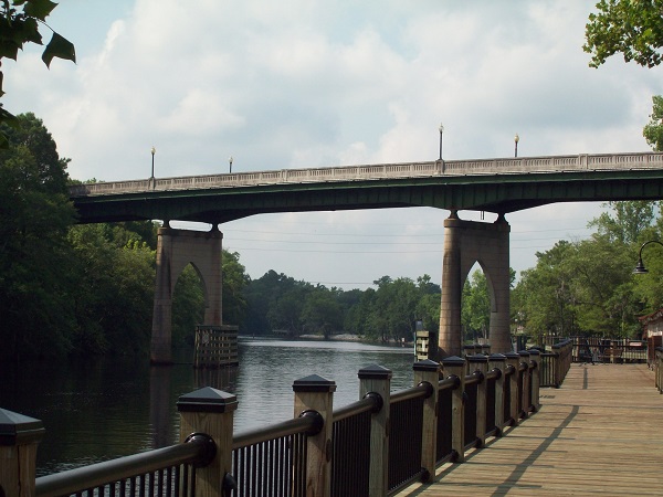
Waccamaw River Memorial Bridge in Horry County, SC (Courtesy of Wikimedia Commons)
Results
Project Title: Evaluating Ordinances and Policies to Reduce Flood Risk in Horry County, South Carolina
Location: Horry County, South Carolina
The Team:
April O’Leary, Horry County Rising, [email protected], 803-216-1718
Patrick Marchman, Michael Baker International, [email protected], 206-371-8458
Pamela Braff, NOAA, [email protected], 412-260-7502
The Initial Challenge:
Horry County is a coastal community in the northeastern coastal plain of South Carolina. Located along the Atlantic Ocean, with three major rivers (Waccamaw, Little Pee Dee, and Lumber Rivers), more than 50% of the incorporated county includes wetlands, marshes, and other water features. Well known for its beaches, including the popular tourist destination, Myrtle Beach, Horry County is also home to the City of Conway, a historic river town established in 1732 along the Waccamaw River, as well as numerous wetlands, forests, and farmlands.
Horry County is also the largest county in South Carolina and the second fastest growing municipality in the nation. More than 35,000 people have moved to the county over the past two years and conservative estimates of population growth predict 275,000 new residents by 2040. The growing population of Horry County has led to an increase in development and urbanization. However, the current county codes, ordinances, and infrastructure were not designed to accommodate the current pace of population growth and development. Since 1996 the county has seen a 22% increase in impervious cover, and loss of forested and wetland area. With about 24% of the county located within the 100-year floodplain, continued development and urbanization have contributed to an increase in flooding.
Over the past four years, Horry County has experienced 3 catastrophic flooding events as a result of Tropical Storm Joaquin, Hurricane Matthew and Hurricane Florence. Residents of Horry County are vulnerable to storm surge, riverine and flash flooding. Although most of the county’s land value and tax base is located along the beachfront, less than 1% of the county is located within the coastal high hazard area. Most flood damage in Horry County has occurred as a result of major rain events, particularly along the Waccamaw River.
The county has recently taken steps to improve flood resilience, including discouraging development of the floodplain and working to improve their CRS (community rating system) score for the National Flood Insurance Program. The county also recently commissioned an engineering firm to evaluate opportunities to increase the resilience of vulnerable areas. However, given the limitations of existing zoning ordinances and codes, challenges still remain in managing development to improve flood resilience.
The Methods
What methodology did you use to produce the project outcome(s) to address the community challenge?
- We analyzed other comparative metropolitan areas for recommendations to both increase resilience and reduce threats to growth in Horry County. We also analyzed existing codes to understand where changes could be made to increase resilience.
What resources, tools, data, or other inputs did you need to complete the project, and how did you get these inputs?
- Resources included comparative area codes and information, and they were provided by web research and conversations with professional contacts and subject matter experts.
How often did the project team meet, and what was the overall time commitment involved?
- Initially, the project team met approximately 2-3 times a month, with an overall time commitment of 10-15 hours per month. The amount of time devoted to the project declined in early March due to challenges associated with COVID-19 pandemic. The project team continued to meet once every few weeks as was possible.
The Results
OUTPUTS: What did you build or deliver through this project?
- The full scope of this project could not be completed as initially planned due to the impact of the COVID-19 pandemic on project team availability. The project team completed an initial review of zoning ordinance and policies currently used to mitigate flood impacts in other counties and regions, and Horry County Rising is well positioned to further evaluate these and other options in a phase 2 project.
IMPACT: What was the impact of the project? Who is better off and how are they better off? Did your outputs inform decision-making, policy changes or actions taken by community members?
- Although we were unable to complete the full project as intended, the initial scoping process and continued conversations with the project team helped to clarify the key community questions and concerns for which a Thriving Earth Exchange project could help advance Horry County Rising priorities. This foundation will help ensure the success of future projects with Horry County Rising, ultimately leading to improved local flood mitigation planning and policies.
How might other people use the outputs, impacts or lessons from this project?
- The outputs from this project will provide the foundation for our phase 2 project. Ultimately we hope the results from the phase 2 project will provide a flood mitigation policy resource for other communities asking similar questions.
Reflections
List 1-3 things that contributed to your success.
- April’s availability and commitment provided more than enough context to understand what the challenges were that this project needed to address.
- Pamela helped the project team stay on task and provided the leadership and guidance necessary for the team to have meaningful outputs.
- Horry County Planning and Stormwater departments contain the expertise needed to amend current regulations and laws.
List 1-3 things you might do differently if you were to do it over again.
- It is difficult to know since COVID-19 appeared and changed everything, but maybe we could have met and decided on alternative courses of action much earlier. No one knew the pandemic would last this long, but we could have acted earlier.
- Evaluate the political climate prior to identifying project goals, the economic assessment could help facilitate the project’s development.
Can you provide some advice for people pursuing similar community science projects?
- Be ready for things to change unexpectedly and be ready to change fast in response.
- Consider the political support prior to identifying project goals to ensure there’s enough political willpower to achieve intended goals.
- Be fully committed to the project tasks and present when working with community partners.
Description
Horry County is a coastal community in the northeastern coastal plain of South Carolina. Located along the Atlantic Ocean, with three major rivers (Waccamaw, Little Pee Dee, and Lumber Rivers), more than 50% of the incorporated county includes wetlands, marshes, and other water features. Well known for its beaches, including the popular tourist destination, Myrtle Beach, Horry County is also home to the City of Conway, a historic river town established in 1732 along the Waccamaw River, as well as numerous wetlands, forests, and farmlands.
Horry County is also the largest county in the South Carolina and the second fastest growing municipality in the nation. More than 35,000 people have moved to the county over the past two years and conservative estimates of population growth predict 275,000 new residents by 2040. The growing population of Horry County has lead to an increase in development and urbanization. However, the current county codes, ordinances, and infrastructure were not designed to accommodate the current pace of population growth and development. Since 1996 the county has seen a 22% increase in impervious cover, and loss of forested and wetland area. With about 24% of the county located within the 100-year floodplain, continued development and urbanization have contributed to an increase in flooding.
Over the past four years, Horry County has experienced 3 catastrophic flooding events as a result of Tropical Storm Joaquin, Hurricane Matthew and Hurricane Florence. Residents of Horry County are vulnerable to storm surge, riverine and flash flooding. Although most of the county’s land value and tax base is located along the beachfront, less than 1% of the county is located within the coastal high hazard area. Most flood damage in Horry County has occurred as a result of major rain events, particularly along the Waccamaw River.
The county has recently taken steps to improve flood resilience, including discouraging development of the floodplain and working to improve their CRS (community rating system) score for the National Flood Insurance Program. The county also recently commissioned an engineering firm to evaluate opportunities to increase the resilience of vulnerable areas. However, given the limitations of existing zoning ordinances and codes, challenges still remain in managing development to improve flood resilience.
The Project
Horry County Rising has identified two objectives for a Thriving Earth Exchange project. The first and primary objective is to analyze existing zoning ordinances and policies to protect communities from riverine flooding throughout the US. This analysis should include a summary of best practices and recommended actions to reduce flood risk in Horry County (or the City of Conway), SC.
The second objective is to complete a benefit cost analysis of implementation of the recommended policy actions in Horry County (or the City of Conway), with a focus on opportunities to grow the economy, community protection, and equity. If necessary due to time/resource constraints, the second objective may be reserved for a phase 2 project.
As a result of this collaboration, Horry County Rising will gain a better understanding of policy options available to mitigate riverine flooding risk in their community. This information will help the community better target future efforts, and provide critical data (e.g., associated costs and benefits) needed to advocate for flood resilience planning and policy.
Project Team
Community Lead
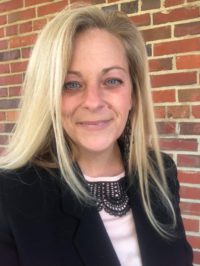
April O’Leary is a Flooded Family Advocate with Horry County Rising, located in Horry County, South Carolina. April lives in the City of Conway, a beautiful historic river town with her husband and two children. City of Conway is located along the Waccamaw River and has experienced several catastrophic flood events in recent years. After Hurricane Florence the Waccamaw River crested at 21.16 feet, 12+ feet above normal level and flooded April and her family along with 400 city residents. April works with residents across Horry County South Carolina through Horry County Rising, a grassroots organization focusing on flood mitigation that engages impacted families in local government. April has 25+ years working in non profit management assisting vulnerable populations and has a BA.
Community Scientist

Patrick Marchman, AICP CEP is a hazard mitigation planner with Michael Baker International/Resilience Action Partners, supporting U.S. FEMA Region VII in Kansas City, MO. His work has centered around the intersection of hazard mitigation/disaster risk reduction, climate adaptation, environmental sustainability and community resilience. Patrick also founded and leads the American Society of Adaptation Professionals’ Climate Migration and Managed Retreat member interest group and serves on the leadership of the Climigration Network.
Community Science Fellow

Pamela Braff is a Coastal Climate Extension Specialist at the Virginia Institute of Marine Science and Mid-Atlantic Regional Integrated Sciences and Assessments program. She provides tailored, decision-relevant information on the implications of climate variability and change to coastal communities and stakeholders throughout the Chesapeake Bay region. Her research is motivated by community needs, focusing on the resilience of coastal communities to climate change and sea level rise.
Pamela is currently working on several initiatives to advance extreme weather and climate change resilience in the Chesapeake Bay region, including the development of localized, context-specific climate impact summaries and an inventory of existing climate resilience tools and resources. She also provides state agencies and local governments with technical support for coastal resource and flood risk management.
Pamela received her B.A. in Marine Science from Boston University, an M.S. in Forest Resources and Environmental Conservation from Virginia Tech, and is a PhD candidate at the Virginia Institute of Marine Science.
Collaborating Organizations
Thriving Earth Exchange has partnered with Higher Ground which supports grassroots flood groups across the country by helping them develop strategies for a sustainable future. Thriving Earth Exchange is working with several of their grassroots groups to connect them with scientists who can help them better characterize neighborhood-level flood risks and work effectively with local decision makers to mitigate those risks.
![]()
Status:
Complete,
Location:
Horry County,
South Carolina,
United States,
Managing Organizations:
Thriving Earth Exchange,
Project Categories:
Flooding,
Project Tags:
No tags