
Bulacan, Philippines team vet hazard maps in communities
The Bulacan, Philippines team is getting close to having hazards maps vetted with the 7 communities of Bulacan province along Manila Bay. The hazards simulation that Joy Santiago and Jake Mendoza planned to do in June will occur in the next couple of weeks with the expectation that they will have sufficient information for AKAP-KA Manila Bay community leaders to provide guidance as to who will be affected by increased storm surge, should the aerotropolis development proceed.
In the words of John “Warner” Carag, the AGHAM representative with the Thriving Earth Exchange project:
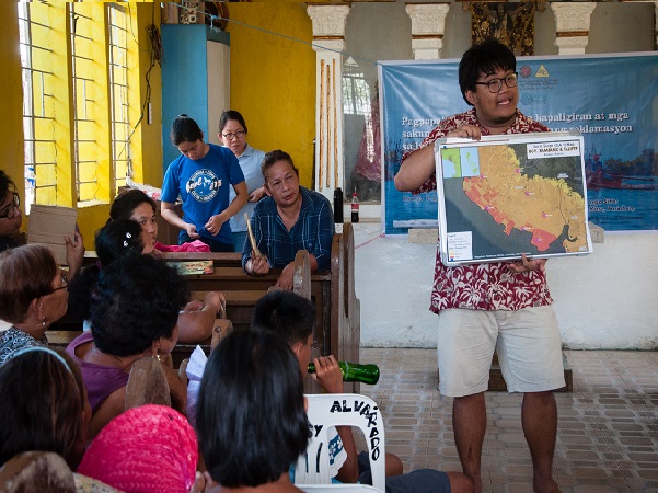
- On April 26, 2019, the geohazards assessment team consisting of members of AGHAM, AKAP-KA Manila Bay, graduate students and professor from the National Institute of Geological Sciences, together with some locals, interviewed a total of 35 households in 7 coastal communities in Brgy, Taliptip, Bulakan, Bulacan. The group identified storm surge and flooding from a nearby river as the main hazards affecting the communities in this part of north Manila Bay, Philippines.
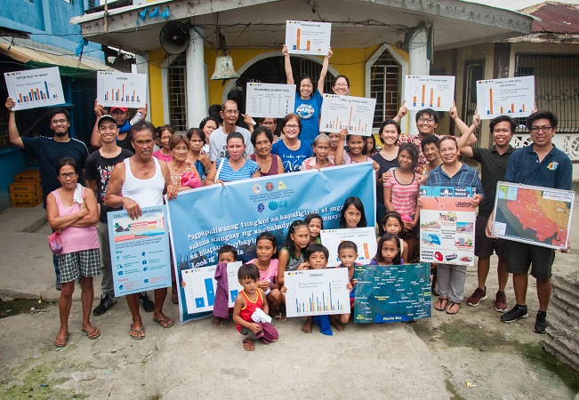
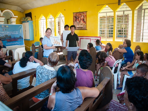
- On June 1, 2019, the team invited the residents of the communities and articulated the results of the survey in Bunutan, one of the coastal island communities. One major insight from the interview is the resilience of the residents. Some residents have lived in the area for more than 60 years and have never experienced any death nor injury due to storm surge or flooding events. An early warning system is in place in which storm advisories are routinely sent through SMS by the barangay captain to the officer in charge of each coastal community. In this way, the communities can prepare for evacuation to the mainland before the storm’s landfall.
- Concerning the threat of displacement due to the construction of the aerotropolis by San Miguel Corporation, the households from the 7 coast island communities interviewed were almost unanimously against this reclamation project. Residents cite loss of livelihood, absence of alternative livelihood skills, loss of residence and identity as the main reasons why most of them would choose to stay in the area amidst perennial geohazards. They do not need to buy food since resources are plenty in the coastal area, like crabs and fish, which the residents also sell to sustain their children’s education in the mainland. Therefore, high resilience of the community and heavy reliance on the coast for food and livelihood suggest that the presence of hazards cannot be used to justify the displacement of the coastal island communities which would impact thousands of Filipino families.
 Bulacan is not the only province along Manila Bay facing reclamation issues. Thus, the project team plans to writ up their methodology so that AGHAM and AKAP-KA can replicate this project all along Manila Bay.