FLASH at Fall Meeting
JJ Gourley attended the 2016 AGU Fall Meeting in San Francisco, CA to present a poster highlighting recent accomplishments and next steps for FLASH. Click here to download his poster!
Development of a mobile app for flash flood alerting and data cataloging
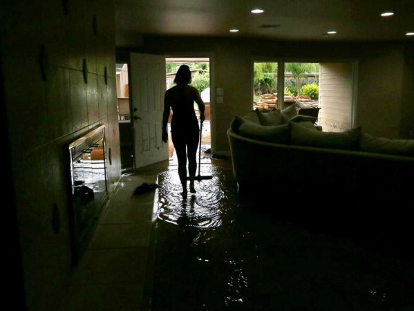
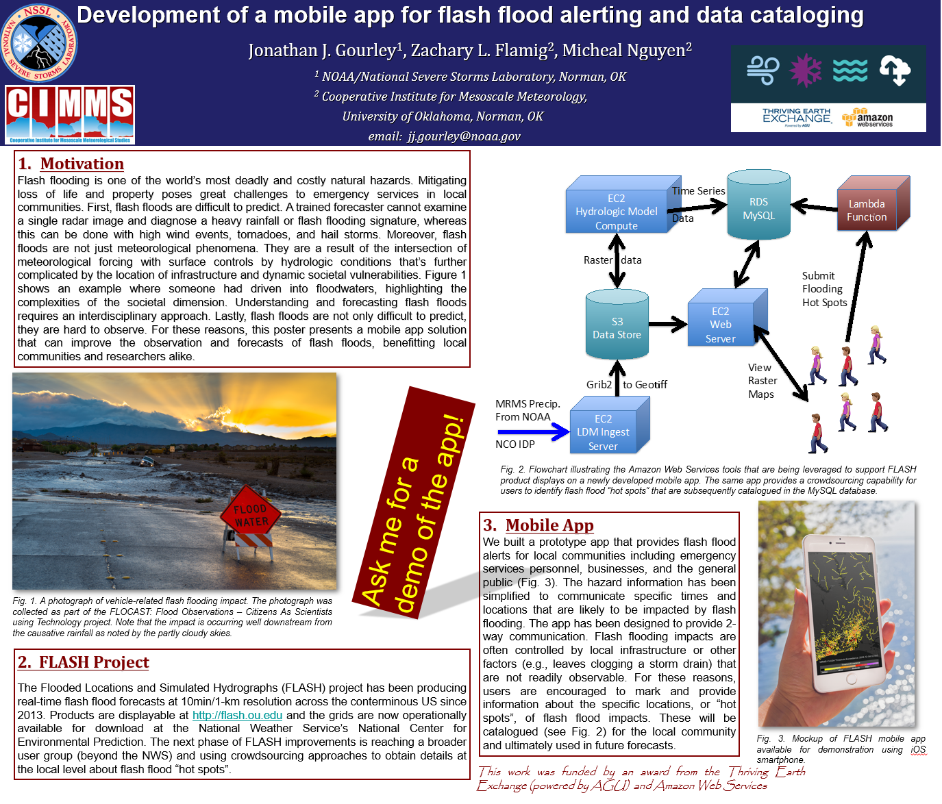 No matter how accurate and specific a forecast of flash flooding is made, there are local nuances with the communities related to the built environment that often dictate the locations and magnitudes of impacts. These are difficult, if not impossible, to identify, classify, and measure using remote sensing methods. This presentation presents a Thriving Earth Exchange project that is developing a mobile app that serves two purposes. First, it will provide detailed forecasts of flash flooding down to the 1-km pixel scale with 10-min updates using the state-of-the-science hydrologic forecasting system called FLASH. The display of model outputs on an app will greatly facilitate their use and can potentially increase first responders’ reactions to the specific locations of impending disasters. Then, the first responders will have the capability of reporting the geotagged impacts they are witnessing, including those local “trouble spots”. Over time, we will catalog the trouble spots for the community so that they can be flagged in future events. If proven effective, the app will then be advertised in other flood-prone communities and the database will be expanded accordingly. In summary, we are engaging local communities to provide information that can inform and improve future forecasts of flash flood, ultimately reducing their impacts and saving lives.