
Higher Ground Communities Discuss Flood Risk Maps
June 7, 2019
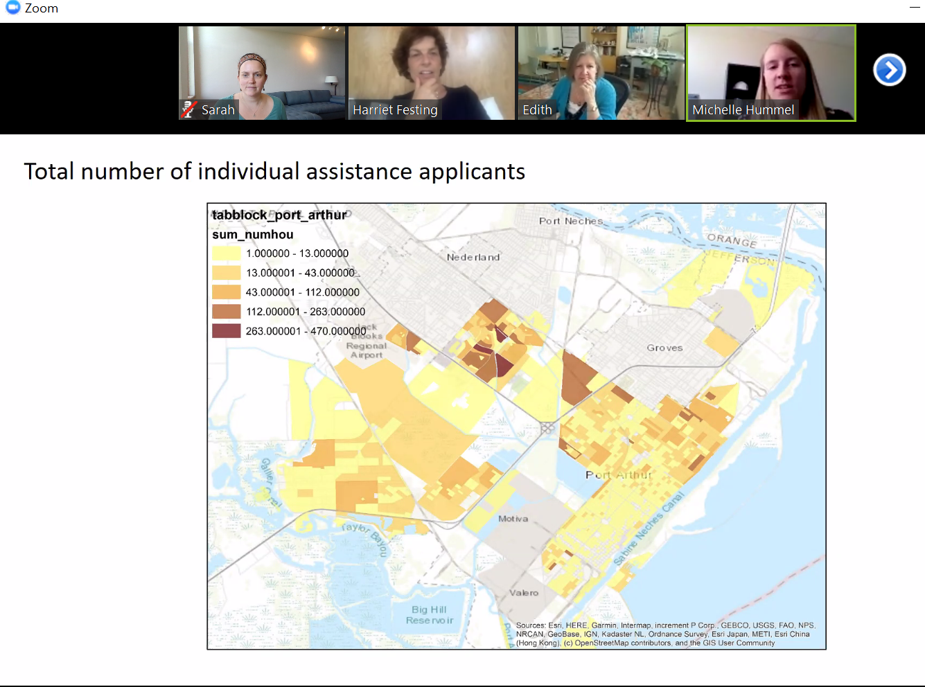
Together on a Zoom call on Friday, June 7th, the Higher Ground communities and Thriving Earth Exchange team came together to discuss initial map outputs from the mapping work Michelle Hummel is doing across four U.S. communities. Michelle shared some initial maps using individual assistance claims data from FEMA for Port Arthur, TX. Drawing on connections with Fair Share Housing, Natural Resources Defense Council (NRDC), and Illinois Department of Natural Resources, the team is preparing maps that draw on individual assistance claim data, digital elevation models (DEMs), LiDAR data, and repetitive loss data.