Apply now to join our next cohort of Community Science Fellows and Community Leads!

The Team
Ed Browne, Residents Against Flooding, [email protected]
Dean Bixler, Residents Against Flooding, [email protected]
Steven Emerman, Malach Consulting, [email protected]
Results
The focus of the Houston, TX project was to work with a Licensed Hydrologist to serve as an expert witness for a case to the Office of Inspector General (OIG) at the Department of Homeland Security (DHS) regarding fraudulent model inputs to a series of flood insurance rate maps. Ed Browne and Dean Bixler of Residents Against Flooding (RAF) partnered with Dr. Steven Emerman to craft a request for DHS audit/investigation of a Letter of Map Revision (LOMR) and Conditional Letter of Map Revision (CLOMR) that used fraudulent model inputs to illegally remove the Pine Crest Golf Course from the 100-year floodplain.
With Dr. Emerman’s expert witness, the group produced a report that carefully outlines the issue. Together, the team determined that the maps, approved by Harris County Flood Control District (HCFCD), were fraudulent: the applicant falsely claimed that the Base Flood Elevation (BFE) was two feet lower and that the property no longer belonged in the 100-year floodplain. This allowed developers to fast-track a development of 900 homes on the 116-acre lot–in an area that once absorbed a significant amount of stormwater. This stormwater (if not properly held on site through improved drainage) will very likely flood downstream homes and businesses.
Methods
Dean and Ed pulled together any datasets they could obtain: flood insurance, LOMRs, communications between the applicant and the County, GIS files, and metadata for the models. Dean downloaded the Hydraulic Engineering Center – River Analysis System (HEC-RAS) software from the U.S. Army Corps of Engineers and utilized QGIS (open sources GIS platform) to create maps of the Pine Crest Golf course. HEC-RAS allowed Dean to observe the flow path of the water.
Project Outputs:
Project Impacts:
During their investigation, the team corresponded with HCFCD, sending a batch of questions to gain clarification regarding the model assumptions and basis of maps – as a result of a meeting with RAF, HCFCD agreed to re-examine their data.
Reflections
From this project, others may learn better ways to partner with Thriving Earth Exchange for their own purposes. For instance,
The team noted that the following contributed to the success of the project:
However, there were a few key things that the team would do differently if they had the chance to do this project again:
To other teams currently pursuing Thriving Earth Exchange projects and for those that anticipate doing a Thriving Earth Exchange project, the team recommends:
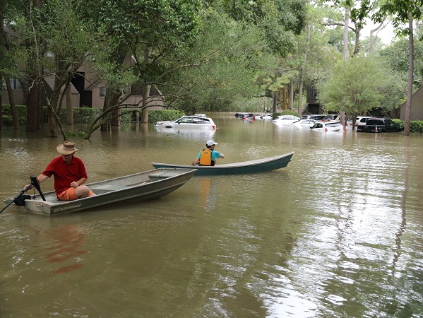
Although Texas has long experienced weather extremes, the intensity and frequency of major storm events is increasing. The recent flooding and damage caused by Hurricane Harvey left Southeastern Texas devastated. Rainfall totals shattered previous records; over a four-day period, many areas received more than 40 inches of rain. At least 80 fatalities have been confirmed and recovery efforts are expected to continue in the weeks and months ahead. The preliminary damage costs from Harvey are upwards of 70 billion dollars.
In 2009, eight years before Harvey hit Texas, a community flood group called Residents Against Flooding (RAF) formed to bring awareness to the public about the impacts that un-mitigated development can have on neighborhood flooding. Increased development in and around Houston leads to higher volumes of stormwater runoff from parking lots and roofs into surrounding neighborhoods, and since Houston has mostly non-porous, clay soils, water runs off easily. RAF is trying to change the embedded rules and city code structure to improve flood control. RAF leaders live in the Memorial City area on the west side of Houston but they have thousands of members from across the city. The group has 700+ Facebook members, 4000+ Twitter followers and a dedicated website.
A few drainage studies have been completed in Memorial City over the years by various engineering firms. One study in 2001 showed the neighborhood falling outside of any FEMA mapped floodplain, yet still recommended installation of at least 4 detention ponds and numerous drainage improvements. An expensive Regional Drainage Study was completed in 2012 after 500 homes flooded in a slow moving 2009 thunderstorm. It found that most neighborhoods did in fact fall within the floodplain yet FEMA Flood Insurance Rate Maps (FIRMs) were not updated to capture this change. Since 2009, RAF has amassed data and evidence confirming the severity of the flooding. On May 25, 2016, RAF filed a lawsuit against the City of Houston and the Memorial City Redevelopment (MCRA) seeking remedy related to persistent flooding.
This project has been conceived and designed in partnership with community leaders at RAF and Flood Forum USA. Due to the heightened attention on Houston in the wake of Hurricane Harvey, this has the potential to be a highly visible project. The pending lawsuit mentioned above may make the project and the findings more contentious or controversial. TEX will help all the project participants navigate this together by helping to design a project that answers community questions based on rigorous practice and sound scientific evidence.
Current RAF Board Chair Ed Browne serves as the community lead. Ed commits to engaging with the scientific partner by providing local knowledge and strategic direction over the course of the project.
Community Leads
Ed Browne and Dean Bixler are the leaders of Residents Against Flooding in Houston, TX.
Bios coming soon!
Science Liaison
Steve Emerman is the owner of Malach Consulting and former Associate Professor of Hydrology at Utah Valley University.
Bio coming soon!
This project is part of one of TEXs’ new cohorts. TEX has partnered with Flood Forum USA which supports grassroots flood groups across the country by helping them develop strategies for a sustainable future. TEX is working with ten of their grassroots groups to connect them with scientists who can help them better characterize neighborhood-level flood risks and work effectively with local decision makers to mitigate those risks.

(c) 2024 Thriving Earth Exchange