
Assessing Flooding and Hydrodynamics for Improved Stormwater Management
Natchitoches, Louisiana, United States
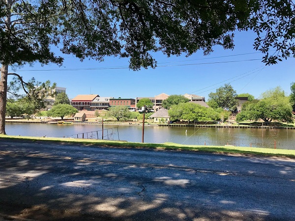
Results
Project Title: Assessing Flooding and Hydrodynamics for Improved Stormwater Management
Location: Natchitoches, LA
The Team:
- Tanzina Afrin, Ph.D. Student, Department of Geography and Anthropology, Louisiana State University
- Traci Birch, Assistant Professor, Architecture, Louisiana State University
- Kory Konsoer, Assistant Professor, Department of Geography and Anthropology, Louisiana State University
- Rick Nowlin, (Former) President, Parish of Natchitoches
- John Richmond, President, Parish of Natchitoches
- Brad Sticker, Water Resources Engineer, State of Louisiana
- Joyce Stubblefield, Environmental Protection Agency
- Nick Verret, City Engineer, Parish of Natchitoches
Support for the project was also provided by:
- Ronald Corken, Attorney, City of Natchitoches
- Karlton Methvin, President, Natchitoches Levee & Drainage District
- Lee Posey, Mayor, City of Natchitoches
The Initial Challenge:
The project area lies in a relatively confined area between the Red River and Cane River Lake that was once a branch of the Red River. It has historically been used in agriculture due to the rich soil deposited over centuries of river flooding. In the past 50-75 years there has been significant commercial and residential development. What was once a large area of open or agricultural land is experiencing development including a large number of streets, structures and large paved parking lots. Because of insufficient and uncoordinated planning of storm water management, the area experiences frequent flooding problems. The general purpose of this project is to identify the principal causes of the flooding and to develop a plan of action to address the problem in an environmentally positive manner.
The primary purpose of this project was to analyze the hydrology and hydraulics of the project area and to develop a plan to address the frequent flooding of homes and businesses in the area.
The Methods
The project team met monthly via teleconference to set goals, reflect on progress, and maintain alignment on progress and plans.
Role definition between scientific partners and community collaborators was relatively delineated, with the scientists implementing the hydraulic and hydrologic modeling effort, and community leaders ensuring the outputs were useable in their local context and that plans were well established to use it. Upon final delivery of the model, community leaders were ready to begin with initial outreach to local landowners.
The Results
The primary output of this project is a hydraulic and hydrologic model of Natchitoches parish. This was shared with the community in final form as a summary report detailing outputs, conclusions and underlying methodology. The H&H model itself was also transferred to the community for manipulation and use beyond the project.
This Thriving Earth Exchange collaboration is the first step of a longer-term effort by Natchitoches to ultimately develop and implement a flood management plan for the improvement of quality of live and economic benefits for residents and businesses in the community. The modeled hydrology and hydraulic conditions of the project area allows Parish leaders to move forward with the pursuit of other planned outputs, including:
- Exploring potential infrastructure improvements to improve storm water management
- Identifying costs and funding sources for infrastructure improvements
- Revising existing planning and zoning ordinances to direct future development
- Creating a body of local support for plans and actions
Description
Natchitoches is a small city in the northern Louisiana parish of Natchitoches. Colonized by the French in the early 1700s, the community was named after the indigenous Natchitoches people and served as a French outpost on the Red River for trade with Mexico. Following the Louisiana Purchase in 1803, cotton plantations expanded in the areas along the river—freight transported cotton to Texas and fueled a population boom. Downtown Natchitoches contains numerous historic buildings and is nationally recognized as a Preserve America Community. After the course of the river changed, cutting Natchitoches off from its reliable connection to the Mississippi River, the Cane River formed in its remnants. The eastern part of the city sits within a crescent bend of the Cane and is susceptible to flooding during heavy storm events.
Natchitoches Parish has observed steady population growth during the past 20 years. In the eastern portion of the city and adjacent lands, development is on the rise. New investments in residential and commercial development continue to strain an inadequate drainage system. During heavy rainstorms a gated structure that allows the city to release flood waters to the Red River can become overwhelmed. Flat slopes trap the water in East Natchitoches, causing disruptive flooding throughout the community. A by-pass slotted for development within the next 2 years will encircle downtown in order to alleviate traffic and open new areas for development in the eastern part of the City and adjacent lands. Despite these benefits, there are concerns that the bypass could exacerbate the flooding throughout the city.
A historic lack of investment and attention to northern Louisiana have inhibited the parish from making the appropriate strides in storm water management and sustainable development. The most recent hydrologic and hydraulic (H&H) study was conducted at least 20 years ago and provides outdated information for flooding challenges exacerbated by urban development and climate change.
As a community, the City and parish are interested to see development move forward in a sustainable manner to mitigate for increased stormwater runoff. Natchitoches needs a comprehensive drainage study to understand how the water flows through the system and how open swales can be redesigned to reduce flood risk. Additionally, the city and parish would like to understand how the introduction of green infrastructure features can help control and alleviate flooding while enhancing the natural beauty of their community.
Project Team
Community Lead

Rick Nowlin has served as the President of the Parish of Natchitoches since December 2012 and is the local community lead for the project. As Parish President, he is elected by the voters to be the chief executive official of the Parish. Prior to serving as Parish President, Nowlin represented District 23 (Natchitoches and Winn Parishes) in the Louisiana House of Representatives.
Rick is also the owner and CEO of N&A, INC., Consulting Engineers and Land Surveyors, a multidiscipline professional firm with offices in Natchitoches and Jena, Louisiana. In this capacity, he has been involved in the design and construction of many public infrastructure projects in the central Louisiana area.

Mayor Lee Posey became mayor of the City of Natchitoches in 2012 and is currently serving his second term. Prior to becoming mayor, Mayor Posey served on the Natchitoches City Council for 20 years. As a lifelong resident of Natchitoches, Mayor Posey’s vision for Natchitoches is to continue to preserve the history while improving the City’s economic development, infrastructure, and tourism. During his term, Mayor Posey has dedicated his time to park improvements, street and waterline infrastructure rehabilitation, downtown riverfront redevelopment, and constructing a sports complex facility all in the City of Natchitoches. As a second generation graduate of Northwestern State University, Mayor Posey has strong ties to the university and spends time collaborating with university officials on new ideas and opportunities for students and staff to become involved in the community. Lastly, Mayor Posey has strong desire to promote healthy living in the community. This past year, the City has implemented Ready, Set, Go Natchitoches! which encourages healthy eating and exercise through a mobile market and portable park.
Scientific Partner

Kory Konsoer is an Assistant Professor at LSU’s Department of Geography and Anthropology and part of the Geomorphology Research Group. He is interested in process fluvial geomorphology, particularly the coevolution of river flows and channel morphology, and how vegetation influences rates of sediment transport and planform dynamics. Current research projects are focused on process-based field investigations using hydroacoustics to measure flow turbulence and high-resolution channel bathymetry, terrestrial LiDAR to examine bank roughness and rates of erosion, and geotechnical tests to analyze the resistance properties of floodplain materials. He is also interested in hydraulic geometry of channelized flows and the scaling relations among small to large rivers, submarine channels, and extra-terrestrial channels of Mars and Titan.
Collaborating Organizations
The EPA’s College Underserved Community Partnership Program (CUPP), has assisted in the scoping of this project with Natchitoches and Louisiana State University (LSU). Through this partnership, LSU supported Natchitoches in conceptual planning to outline their needs for a stormwater study—including key questions and objectives to consider. LSU commits to assisting with the search for a scientific expert within the institution as well as engaging in phase 2 of the project to assist with policy implications related to the results of this work (graduate student involvement is encouraged).
Status:
Complete,
Location:
Louisiana,
Natchitoches,
Managing Organizations:
Thriving Earth Exchange,
Project Categories:
Climate Change,
Flooding,
Natural Hazards,
Project Tags:
No tags