
Identifying and prioritizing wetland restoration sites in the Lower Illinois River Valley
Lower Illinois River Valley, Illinois, United States
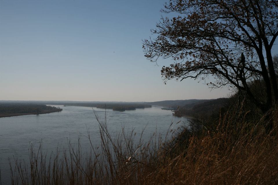
The Lower Illinois River Valley, situated near the junction of the Illinois and Mississippi Rivers, is an important agricultural hub that is threatened by climate change, intense agriculture, levee construction, and river modification, all of which have contributed to an eroded floodplain, frequent flooding, and pollution. The goal of this project is to identify and prioritize areas within the Lower Illinois River Valley that are in need of restoration using a geographic information system (GIS) mapping framework. This tool will enable the Great Rivers Land Trust and other organizations and decision makers to focus on areas where restoration will be most readily achieved and have the greatest impact.
Description
The Community and the Challenge
The Lower Illinois River Valley, located within the west-central part of Illinois, comprises nine counties along the confluence of the Illinois and Mississippi Rivers. These counties—Brown, Cass, Pike, Morgan, Scott, Greene, Calhoun, Jersey, and Macoupin—are rural and predominantly agricultural. Across these rural counties, the Lower Illinois River Valley has some of the richest farmland in the world: Illinois is first in the nation for soybean production, and responsible for 60 percent of the nation’s corn exports. The Illinois and Mississippi River systems are fundamental in providing quality water and agricultural resources; they also provide an important transportation artery that enables commerce with urban centers like Chicago and Bloomington, Illinois, and St. Louis, Missouri.
Unfortunately, the Lower Illinois River has been subjected to extensive agricultural development and severe urban pollution over the last 150 years. In the late nineteenth century, levees were built to enhance floodplain farming. Development continued throughout the twentieth century when water diversions from Lake Michigan began in 1900, navigation dams in the 1930s, and sewage and toxic waste disposal through to the 1950s. The basin’s prairie savannas were also largely converted to row crop agriculture, a change that increased erosion, sediment loading, and nutrient and herbicide transport to the river. The effect of human activity along the Illinois River has left the river highly degraded in its upper reaches and reduced its ability to supply key ecosystem services, particularly clean water, healthy soils, and flood-reducing ecosystems. The increased frequency of extreme weather events due to climate change further exacerbate the degradation of the valley, as does the encroachment of invasive species such as silver Asian carp, zebra mussels, bush honeysuckle, and kudzu.
The Project
The purpose of this project is to develop a GIS tool that allows for the identification and prioritization of potential wetland conservation sites in the nine counties of the Lower Illinois River Valley. Prioritizing factors used in the creation of the GIS tool should include:
- Property ownership and parcel size
- Vegetative cover
- Proximity to existing protected land
- Proximity to waterways
- Ecological health of any waterways that pass through the property
- Soil quality
- Whether the land is highly erodible/eroded as designated by the NRCS.
Additional data may include the presence of Threatened or Endangered species, water quality measurements, etc.
Once restoration sites are identified, field data will be collected during the summer of 2021 to ground-truth GIS layer data. This will be done in cooperation with Principia College. Students and faculty will visit the restoration sites to further support the information organized in the layers.
The resulting GIS mapping tool will help us to identify potential sites and properties with the highest restoration potential. Once our team has identified the sites, we will prioritize which would be best suited for restoration that will return the sites to their natural state and restore their wetland function.
Timeline and Milestones
Our goal is to produce digital overlay maps that will be used to identify areas best suited for land protection initiatives by early 2022.
- By mid-June 2021 – Find a scientist(s) who can help produce the maps
- End of July – Compile map layers and confirm permission for inclusion on our map
- End of October – Student interns from Principia College have gathered field data to be included in the map
- End of November – Develop all compiled map layers and field data into a GIS-based map tool
- End of January 2022 – Test map for the project area and ensure that all resources are well documented and credited, and that the map tool is accessible and shared broadly.
Project Team
Community Leaders
 Alley Ringhausen has served as Executive Director of Great Rivers Land Trust since 2001. He joined Great Rivers in 1999 as developer and manager of the Piasa Creek Watershed Project. Under his leadership, Great Rivers Land Trust has protected thousands of acres of property in Illinois and Missouri, developed wetlands, reduced erosion, planned parks, restored streams and partnered with numerous organizations on a wide variety of conservation projects. Alley received a Master’s Degree in Environmental Studies from Southern Illinois University at Edwardsville, graduating with honors.
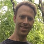
 Dr. Marie Farson earned her PhD at Scripps Institution of Oceanography for the development of a seafloor geodetic positioning system for geophysical stress and strain measurements. Currently working as an Assistant Professor at Principia College, teaching Earth Science and Engineering courses. Previously worked for the US State Department at the embassy in Tripoli, Libya until evacuation in February 2011. Previous work as a Senior Engineer at the Engineering Technology Center, developing acoustic analyses of submarine structures, as Project Manager for Seaworks, Inc. managing the installation of the Underwater Magnetic Silencing Facilities at US Submarine bases, and as an Engineer at Deep Ocean Engineering solving engineering problems related to the design of remotely operated vehicles and instrumentation to perform specialized tasks in including the open ocean, inland lakes and nuclear power plants and conducting worldwide ROV operations: search & salvage (Singapore, Caribbean, California); photographic surveys of pipelines and outfalls (California, Hawaii, Gulf of Mexico); underwater video surveys of dam sites for the United Nations (India); fisheries population mapping and migration studies (Alaska, Gulf of Mexico) and military surveillance and mapping (Panama and Singapore).
 Dr. Lyle Guyon has been with the National Great Rivers Research & Education Center (NGRREC) since 2005, where his primary focus relates to floodplain forest ecology and management in the Upper Mississippi River. Research interests include: floodplain vegetation community dynamics in relation to hydrological and environmental gradients; invasive species control and management; floodplain forest canopy gap dynamics; spatially explicit modelling of floodplain forest succession; river bluff hill prairie restoration; and reforestation techniques in floodplain habitats. The primary goal of his research and monitoring activities is to further our understanding of large river floodplain ecosystems and associated habitats to facilitate their restoration and sustainable management. Additional activities have included: teaching summer field ecology courses at NGRREC, providing technical assistance to multiple federal and state agencies, and coordinating NGRREC’s management of the Palisades Nature Preserve and other environmental research and demonstration areas.
 David Holman is an independent consultant with 15 years in the land conservation field with a specialization in Geographic Information Systems and analysis. He has written over three dozen conservation baseline documentation reports, is the creator of the Illinois Protected Lands Geodatabase and I-View; the nation’s only complete state-level database of all public and private permanently protected natural lands and is the author of the annual “Year in Review” report, a comprehensive summation of conservation land acquisition, restoration and policy projects undertaken throughout Illinois each year. He has also built a database of all lands protected by the 42 members of the Gathering Waters land trust coalition.
Community Science Fellow
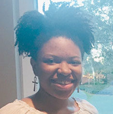 Zavia Jenkins is a recent honors graduate from Stetson University in DeLand, FL, with a Bachelor of Science in Aquatic and Marine Biology. In college, Zavia interned with the St. Mary’s Riverkeeper on an oyster bed shoreline restoration project. Her senior project involved analyzing the density of invasive armored catfish waste in the Volusia Blue Spring. Passionate about protecting and conserving that water and natural ecosystems, Zavia serves as a Thriving Earth fellow, acting as a project manager and collaborating with other team members.
Collaborating Organizations
Enrolling students from 31 states and 27 countries, Principia College provides an outstanding liberal arts academic program in a unique learning environment that supports students’ spiritual growth. Its faculty includes world-class scientists, published authors, noted historians, and celebrated artists and musicians.
The mission of the Great Rivers Land Trust is to promote the preservation and improvement of natural resources principally in, but not limited to, the watershed of the Mississippi River for the benefit of the general public. These resources shall include: land and water resources, the plant and animal life thereon, and the area’s unique scenic, natural, and historic sites. The Great Rivers Land Trust mission will be reviewed every year at the GRLT annual board meeting.
This project is supported by funding from the Gordon and Betty Moore Foundation.
![]()
Status:
Complete,
Location:
Illinois,
Lower Illinois River Valley,
United States,
Managing Organizations:
No organizations
Project Categories:
Conservation,
Project Tags:
No tags