
Who We Are
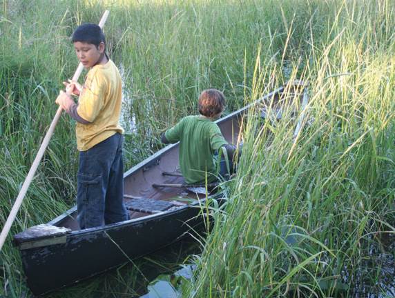
 The White Earth Reservation sits in northwestern Minnesota and contains numerous lakes. Tribal officials routinely monitor the water quality in the largest and most-used lakes, although many of the smaller and less-used lakes are not monitored regularly. These lakes are used for fishing, wild-rice production, and recreational activities.
Wild rice is of tremendous cultural, traditional and economic importance to the Anishinaabeg people of the Great Lakes region, including those who are part of the White Earth Nation. Wild rice harvesting also provides food security and economic activity to the tribe and its members, and is a steady source of income and food.
What We Aim to Achieve
White Earth is requesting the capability to perform a broad suite of measurements that provide a comprehensive overview of water quality relevant to wild-rice harvesting, fisheries, and recreational use, primarily swimming (Box 1). White Earth is also interested in using this to data detect the impact of commercial agriculture operations (including fertilizer run-off), power plants, and leaking septic systems. The goal of the data collection is to identify issues of concern that merit further scientific research and management attention, even if these measurements cannot form the basis for legal action Thus, White Earth prioritizes a system that can be used in many different places over a more precise system that is too expensive or complicated to use widely. Because many lakes in the area are not easily accessible, White Earth would prefer data collection methods that can be compared to remote-sensing data to allow estimates of water quality in remote lakes.
Wild Rice Locations and Sulfate Measurements
View Larger Map
(Credit: Minnesota Pollution Control Agency, Minnesota Department of Natural Resources)
To complement the measurements, White Earth is also requesting a database. This database should incorporate geospatial data and make it easy to contribute new data, review old data, and compare different variables in location and time.
Both the sensors and the database should be usable by individuals without advanced scientific training.
With respect to fishing, the key variable of interest is methylmercury. Mercury is released into the atmosphere by some power plants and can be deposited into rivers and lakes, ultimately accumulating in fish, and sufficient amounts of Mercury can cause harm to unborn babies or young children. There are coal-based plants near White Earth, which motivate the interest in monitoring mercury levels.
Many of the lakes in this region are inaccessible (either on private land or too remote). Because of this, White Earth would like to use the data collected to ground-truth satellite measurements and provide on-the-ground data to compare to satellite data to monitor conditions in isolated lakes. The sampling kits should include instructions for comparing data collected in the field with environemental satellite data, along with supporting literature showing established methods of correlating between the two data types.
The accompanying database should be a resource for preserving and analyzing the collected data. It should allow students to examine trends in a specific area, compare water quality across several lakes, and identify or flag areas at risk. The database, like the sensor or sampling kit, should be easy to use by people without a scientific background. The database should allow easy comparison to other geospatial data to look for correlations.
Why is it Important?
Wild rice harvesting also provides food security and economic activity to the tribe and its members. For wild rice, the key variables include nutrients associated with plant life, including Nitrogen, Potassium, Phosphorus, dissolved Oxygen, and Sulfates. The turbidity, color and clarity and pH of water are also known to influence wild rice growth and viability.
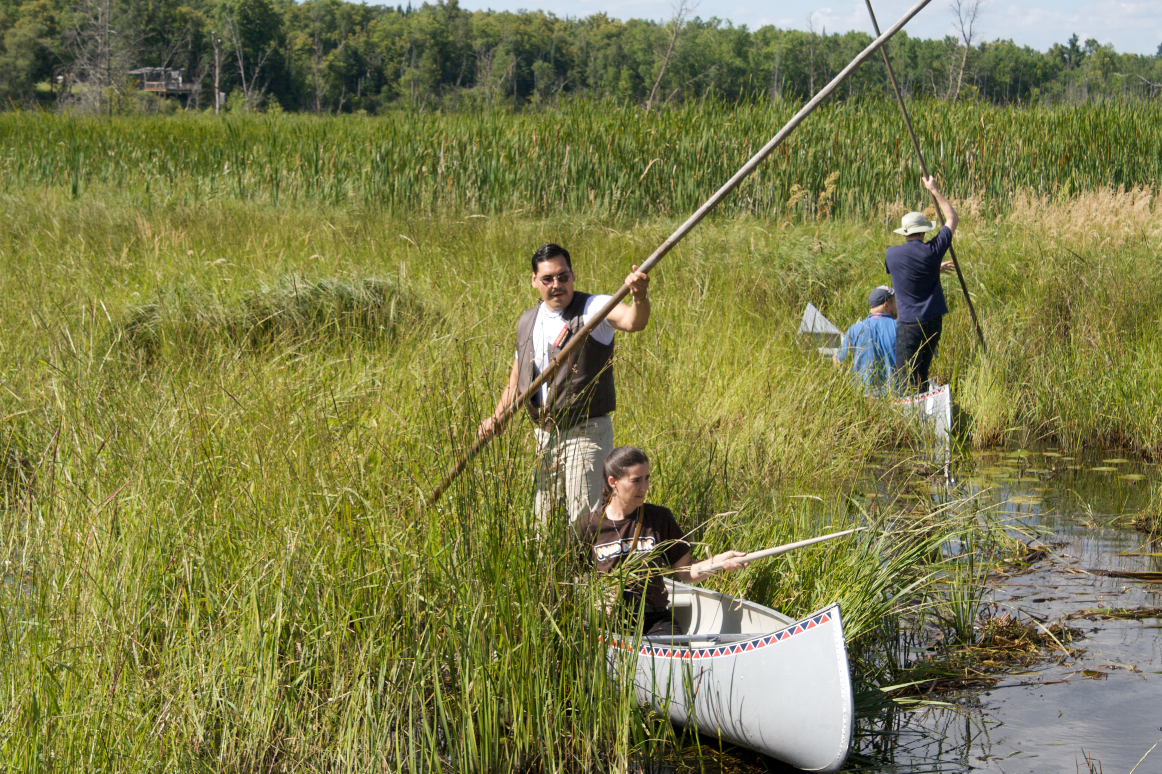
The use of lakes and rivers for recreation, including swimming, depends on water quality and these waterways must be monitored for pathogenic microbial contaminants. A protocol to identify and quantify commonly accepted indicator species for microbial waterborne diseases is sufficient. The White Earth Tribal and Community College does not have microbiological laboratory equipment or sterile laboratory environment, so the sampling protocol and/or equipment must be useable in the field.
A protocol for identifying or detecting invasive species of particular concern in Northern Minnesota is desired. Invasive aquatic animals and plants are spreading through the rivers and lakes of the American Midwest. Maintaining data on the spread of invasive species will help characterize changes in the native aquatic ecology.
The White Earth Nation has successfully completed Phase I and is now looking for funding! To back this project visit their page on:![]()
Phase I Complete
Prize: $2000 for the selected solution(s) in Phase 1
Challenge ID: TEX2013-102 (PDF Version)
The White Earth Tribal and Community College looked for sensors designed to monitor key water quality variables associated with the health of wild rice, fisheries, and the recreational use of freshwater lakes and rivers. The protocol would be low-cost, usable by non-scientists, and produce data products that can be readily compared with relevant satellite data.
Phase 1: Prototype (Solution Submission open for 45 days, Judging for 15 days)
1. Propose a data management system for collecting, geo-referencing, storing, retrieving, comparing and visualizing environmental data collected. The database should be set up so that the Seeker can maintain it onsite, not software as a service (SaaS).
2. Propose a set of sensors (the “Sampling Kit”) that costs less than $200 and can be used by people with little or no scientific training to monitor a suite of representative water quality variables (Box 1).
Multiple solutions may be selected for Phase 2, and the prize will be divided equally between the solutions.
Solution Requirements
- Ease of Use: The sensors and the database should be usable by someone with little to no scientific experience. A child in upper-elementary school should be able to use the sampling kits and database with training and support from adults.
- As many of the measurements as possible should be able to be made directly in the field.
- Flexibility of the database: The database interface should allow queries, comparisons, batch exports and imports, and the examination of maps and trends.
- Sustainability of the database: Software used to manage the data should be open-source, and preference will be given to databases that require less specific expertise to maintain. Cloud-based databases or integration of data into existing databases are acceptable provided White Earth’s access to the data is not compromised.
- Proxies for difficult-to-measure variables are encouraged, with documentation from the scientific literature to show proxy precision.
- Total Cost should be less than $200 per sampling kit.
- Sampling kits or sensors that measure variables that can be compared to satellite measurements are strongly preferred.
Composition of Judging Team
- Two representatives from the White Earth Tribe
- One representative from the White Earth Tribal and Community College
- One scientist with water quality experience
Next Steps
Phase 2: Implementation (Only available to solution(s) selected in Phase 1)
Build 80 sampling kits and work with White Earth to build a sustainable data management system, along with all necessary instructions, so that White Earth residents, including students, can monitor water quality throughout the reservation. The winning solution(s) from Phase 1 will be used as the basis to raise funds to support Phase 2.
Box 1. Required Species for Measurement
- Nitrates
- Potassium
- Phosphates
- Dissolved Oxygen
- Sulfates
- Methylmercury
- pH
- Water Clarity (turbidity and color)
Optional
- Waterborne pathogen indicators
- Protocol for invasive species identification This text area show all text.....
Supporting Literature
Ackerman J., C. A. Eagles-Smith. Agricultural Wetlands as potential hotspots for mercury bioaccumulations: experimental evidence using caged fish. Environmental Science & Technology, 2010, Volume 44, Issue 4, pp 1451-1457 (http://pubs.acs.org/doi/abs/10.1021/es9028364)
Sims L., J. Pastor, T. Lee, B. Dewey. Nitrogen, phosphorus and light effects on growth and allocation of biomass and nutrients in wild rice. Oecologia, September 2012, Volume 170, Issue 1, pp 65-76 (http://link.springer.com/article/10.1007%2Fs00442-012-2296-x)
U.S. Geological Survey. National field manual for the collection of water-quality data: U.S. Geological Survey Techniques of Water-Resources Investigations, book 9, chaps. A1-A9 (http://pubs.water.usgs.gov/twri9A)
Minnesota’s sulfate standard to protect wild rice. Minnesota Pollution Control Agency. Last modified July 25, 2013. (http://www.pca.state.mn.us/index.php/water/water-permits-and-rules/water-rulemaking/minnesotas-sulfate-standard-to-protect-wild-rice.html)