Apply now to join our next cohort of Community Science Fellows and Community Leads!

Tag Archives: Climate Change

Community Insights: Taking action on the front lines of climate change

Aug 11, 2021 Posted by :   Haley McKey No Comments

Anchorage is Alaska’s largest city, with 300,000 residents spread out over an area about the size of Delaware. Part of Dena’ina Elnena (Dena’ina Country), home to members of the Eklutna and Knik tribes and many nationalities, it is a place with deep indigenous roots and a complex cultural and political history. Nestled between the Cook Inlet and the Chugach mountains, Anchorage has long stood as the economic hub of the state and the gateway to the Arctic. 

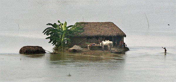
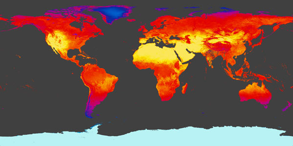
Unfortunately, Anchorage also stands at the front lines of climate change. Alaska’s climate is changing twice as fast as the rest of the U.S., with more frequent rain and snow events, more insect infestations, receding glaciers and a longer wildfire season. Eager to tackle these problems head-on, city administration and residents are working with scientific partners to establish a baseline emissions inventory and create a framework for reducing emissions as part of a wide-reaching Climate Action Plan. 

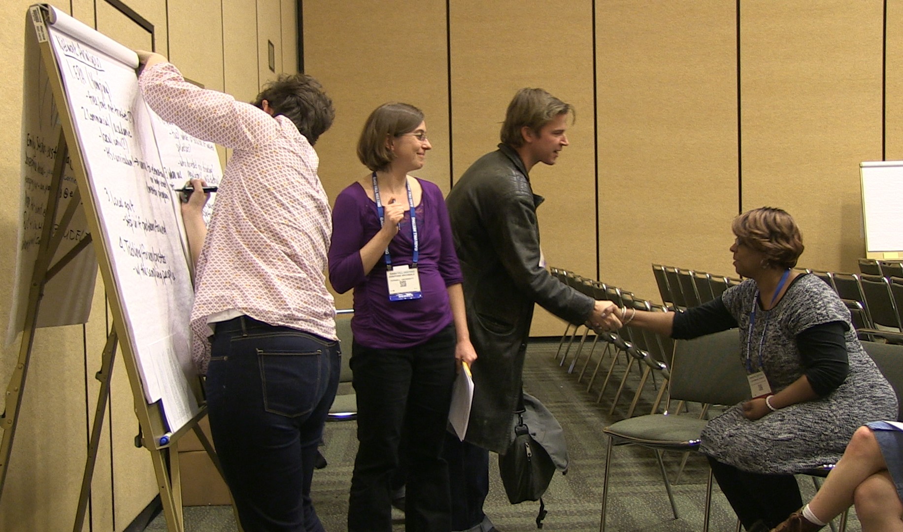
We met with the project’s Community Lead, Shaina Kilcoyne, the Energy and Sustainability Manager for the Municipality of Anchorage, to learn more about the challenges and opportunities Anchorage is facing.

How would you describe your community to someone who’s never been there?

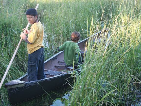
There’s a lot to say about Anchorage. We’re pretty unique. This is where native people have thrived and survived for thousands of years. We’re an outdoor community, and we prioritize parks, trails and greenspaces. There is a lot of natural beauty, and I hope you have the chance to visit someday.

What do you see as the unique strengths of your community?

There are so many unique things about Anchorage and Alaska that I could probably go on all day! Anchorage residents are a resilient peoplewe take pride in doing things ourselves and helping our neighbors. I think it’s unique that we’re as far north as  Oslo, Stockholm and Helsinki, some of the biggest leaders in climate action. That means even a northern city like Anchorage has the opportunity to be a climate leader in the United States and in the world.

What do you see as its unique challenges or struggles?

Something that pervades our everyday life is that we’ve been overly dependent on oil and gas extraction, and it makes it really hard for people to think beyond those sources of revenue and economic development. That revenue has helped build a lot of our infrastructure, but it’s also made it very difficult to diversify [our energy sources]. A lot of people are directly dependent on the oil and gas sector and see discussions of climate change as a threat to that. I get that, but I think that we’ve had these blinders on for too long. Our state has really buried its head in the sand and frankly we can’t afford to push it off any longer. 

What do you think people would be surprised to learn about your community?

So many things! There are more than 100 native Alaskan and international languages spoken in Anchorageour diversity is really cool. When we were creating our Climate Action Plan, we really tried to engage every community and collect their input. It was really important to us because we know that it is these underrepresented populations that see the biggest impacts from climate change. It’s important that we don’t assume that we know what is best for all of our populations. 

In fact, we are creating a Climate Equity Council that can help throughout Climate Action Plan implementation, to give input from different communities on what the priority is, what would be most helpful, where do we start, and what are we missing? It’s gone a little slower than I hoped, but it’s not easy and we’re trying to do it the right way.

What would you advise to others trying to tackle a community issue?

What I would say is don’t be afraid to engage your community. When we started doing outreach, I was very concerned that people were going to yell at me, and that was not the case. More and more, the business community and conservative districts weren’t pushing back like I expected. It turns out your average person is living the effects of climate change, so they aren’t surprised, even if they are wary of what actions you propose. I’m not excited that we are experiencing climate change, but we absolutely are, and because it’s so pronounced here it’s hard to deny that. The conversation has been more at the forefront. The action has been slow to follow, but I do think that will come.

What do you hope Anchorage will be like in 20 years?

I love seeing the progress that we’ve been making, and so in 20 years I hope that not only are we seeing these projects completed, but that we also have the policies and programs in place to make these the norm. I want to see electric vehicles and chargers everywhere, more solar, wind and tidal energy, and us taking the lead in advanced architecture for cold climates. 

I also want to see workforce development not only keeping up but staying ahead of the curve and offering advanced energy and technology jobs and opportunities. I believe that the clean energy transition is an opportunity to allow us to diversify our resources and for future generations to thrive.

Completed: How Can We Make Our Communities More Resilient?

Aug 15, 2014 Posted by :   cfleming No Comments

Who We Are

Screen Shot 2014-10-14 at 2.30.53 PM


The US Department of Housing and Urban Development has opened a National Disaster Resilience Competition to propagate new ideas regarding natural disasters and resiliency for areas that have a history of vulnerability to floods, earthquakes, super storms, drought, heat waves, and high winds. The National Competition calls for applications from any of the 67 states with counties that have been affected by a Presidentially Declared Major Disaster within the past three years (2011, 2012 or 2013).


What We Aim To Achieve

This year-long competition is broken into two phases: phase one calls for broad risk assessments, brainstorming of potential collaborations for different stake holders and proposals for multi-level fixes for disaster relief and community benefits and is open until 3 November 2014. Phase two focuses on details and action which involve HUD helping with reviewing, facilitating access to webinars and resources, and assisting with grants for the implementation of the selected proposals.

Submission Deadline: 3 November 2014

Screen Shot 2014-10-14 at 2.24.39 PMTo learn more about how your community can earn $1 billion towards disaster management and planning click here . Applicants have until 3 November 2014 to submit proposals for consideration.


Giving Local Experts New Tools

Jul 17, 2014 Posted by :   raj pandya No Comments

Dr. Dan Wildcat (of Haskell University) and Bull Bennett (of Kiksapa consulting) have been building their relationship with tribal colleges for years. Having worked on environmental issues for the past 20 years Dan Wildcat has built a large network of scientists, potential mentors and students. Bull Bennett has been a mentor for years to both students and faculty in areas of GIS, writing, and science research. The two prioritize putting students at the center of their research by emphasizing personal growth, continued learning, and investment in their topic.

Dan and Bull are constantly learning about new reservations and cultures 

As directors of the Summer Research Experience for Undergrads program, they are not afraid to challenge the students during three weeks of intensive learning. In return, both Dan and Bull are constantly learning about new reservations and cultures. The outcome, as they so proudly put it, is that they are beginning to see many of these students going onto graduate schools and entering science technology engineering and mathematics (STEM) fields.


The Power of Externships

Externships are generally hands-on, short-term experiences, similar in nature to internships but with more practical applications and career-oriented goals. An externship will generally last for 8-weeks during the Summer period; 6 weeks are used to learn about climate change in the lab, and 2 weeks are used to conduct research in the field addressing climate-related issues according to the student’s interest.


Remembering E-x-t-e-r-n-s-h-i-p

E-xperience of a lifetime for students from tribal colleges across the country to gather and learn new technologies to address local issues.

X-amples of these projects include: “Identifying a Decrease in Agriculture on the Navajo Nation over past 22 years” and “Analyzing medicinal plant stress from climate anomalies”.

T-ools the students learn include Global Information Systems (GIS), remote sensing, and, map design to name a few.

E-veryone works on a project that is relevant to their community making their impact even greater.

R-esearching, learning, and, networking with other students for 3 weeks at Haskell Indian Nations University in Kansas then continuing research from home for the remainder of the summer.

N-ASA Tribal Colleges and Research Universities Project is one of the many partnerships forged between Kiksapa Consulting and Haskells Indian Nations University.

Students bring their expertise on local affairs to meet the challenges they are given.

H-oping to increase dialogues with reservations in order to improve mutual understanding and productivity.

I-nvesting in the students and their communities has made this program successful for nearly a decade.

P-roducing change agents ready to improve their communities and tackle climate change.


Weather Forecasting in India and Bangladesh

Jul 17, 2014 Posted by :   raj pandya No Comments

How you say ‘1.5 inches’ can save a life. It can save packages of seeds and herds of cattle. The language used to deliver a forecast is important. The timing of when these forecasts are given is equally important for people that are affected by extreme weather. In places like Bangladesh and India, the communities usually only have two to three day’s warning, leaving them vulnerable and unable to prepare for floods or monsoons.

Peter Webster’s research uses multiple forecasts to give up to 10 days advance warning of a storm based on probability.

How this probability is explained, along with when it is given, has the potential to save lives during destructive weather. With the use of probability based forecasts, instead of reacting to weather trends, people can make proactive and informed decisions on when and how to evacuate.

5

South and East Asian countries like Bangladesh and India are vulnerable to floods, droughts, and other forms of extreme weather. Millions of residents are affected both directly and indirectly when fertile areas are flooded. These floods kill cattle, leave people homeless, and destroy agricultural supplies. Farmers buy their agricultural supplies (seeds, tools, etc.) with loans, and when those supplies (and crops) are destroyed in a flood or monsoon, the farmers and their families are subjected to generations of debt. On average, these super storms can cause 1 billion USD in damage. Using probabilistic forecasts can provide more time for planning and evacuation. The only time my family needed to prepare for a storm was during the recent hurricane Sandy. The advance warning allowed friends and neighbors to stock up on foods and move inland. Although I was out of town for the storm itself, the weather report used terms that could be easily understood which helped during preparation. The terms used by the local weather reporter to describe Hurricane Sandy could not be used to describe an upcoming storm in Ahmedabad, India.

Instead, the forecast needs to be presented in culturally relative terms.

For example, saying “enough rain to reach your doorstep” as opposed to “1.5 inches of rain” makes all of the difference.

05flood.60

Peter Webster learned that as an outsider, it is nearly impossible to come into a new place and introduce your ideas and plans without collaboration. He compared it to a social worker going into one’s home and telling the leader of the household how to better manage things. Since every culture has their own way of doing things, getting them to change is nearly impossible as an outsider.

Working with new cultures to better understand them and involve them into the solution is what community science is all about.

This includes building a sense of trust, taking time to understand the long term needs of the community, and making sure that the proposed solution can be properly applied without the researchers. This is about working with people, not for them.
In the end, I don’t believe that we are required to submit to weather patterns and natural disasters. There will be natural disasters and extreme weather, but with preparation there can be less loss involved with these occurrences. In places like Bangladesh and India, having more time to prepare for the storms is the difference between life and death, as well as millions of dollars in damages.

Completed: How Many Ways Can Climate Science Data be Used?

Jul 17, 2014 Posted by :   raj pandya No Comments

Who We Are

imagesThe OpenNEX challenge invites the public to propose new ideas on how to use climate data from NASA satellites. Scientists with backgrounds in global land surface imaging, vegetation conditions, climate observations and climate projection may be well prepared to propose new ideas on how to use climate data by July 31st 2014 for the chance to win $10,000. Selected ideas will be invited to the "builder" phase for development or application.


What We Aim To Achieve

OpenNex challenge is looking for partners and ideas relating to climate resilience hosted by Innocentive, Nasa and Amazon Web Services.


This Challenge is Now Complete

Do you specialize in climate science, software engineering, or data analysis?

To learn more about the challenge visit here.


Taking Neighborhood Health to Heart

Jan 27, 2014 Posted by :   raj pandya No Comments

Who We Are

Taking Neighborhood Health to Heart (TNH2H) is a community-based participatory research project which began in 2006 and involves: five diverse urban Denver neighborhoods: Park Hill, Northeast Park Hill, East Montclair, Northwest Aurora and Stapleton; the University of Colorado Denver; and, the Stapleton Foundation.


What We Aim to Achieve

TNH2H are interested in partnering with Earth and space scientists to investigate environmental factors that influence health and well being in their neighborhoods. Because TNH2H values collaboration between scientists and neighborhood members, they are interested in inviting scientists to partner with them and explore several potential issues, rather than soliciting solutions to a single challenge via the Thriving Earth Exchange web-based challenge platform.


Why is it Important?

The neighborhoods are very diverse in terms of race/ethnicity and income. Some of the neighborhoods can be described as food deserts with limited access to healthy affordable foods. TNH2H research has helped address this, including creating urban community gardens and changing city policies to allow the sale of produce from backyard gardens.

Taking Neighborhood Health to Heart (TNH2H) participants are interested in local air quality and its impacts on health; the quality of their drinking water; potential levels of soil contamination; and their Denver neighborhoods’ vulnerability to natural hazards and environmental change, especially climate change. Like many areas of Colorado and around the U.S., TNH2H neighborhoods must also respond to climate- and weather-related challenges, including long periods of drought and more recently extreme rainfall (Fall 2013 storm)


Currently TNH2H are looking for additional funding. If you have a contact or funding resource you would like to share, email us!


What Have We Achieved So Far?

Phase I: Completed

Solutions were submitted during the AGU Fall Meeting 2013. Additional challenges may be developed as requested by TNH2H.

Challenge ID: TEX2013-103

Four representative members of TNH2H met with almost 80 AGU members for a two-hour brainstorming session. After introducing TNH2H, their use of community-based participatory science, and the priorities the neighborhood residents have identified, the TNH2H members led small working groups centered on climate change, geohazards, water quality and soil quality.

These working groups were asked to envision how scientists and neighborhood residents would work together to address local issues. After the session, several scientists expressed interest in learning more about participatory science. TNH2H left with detailed questions for the neighborhoods to consider, and connections to scientists and organizations that could contribute to shared goals.

The Thriving Earth Exchange team will work with TNH2H and report on the next steps, inviting further participation from AGU members and other scientists. This will continue to be developed, to address environmental challenges according to priority.


White Earth Nation: Water Quality

Sep 18, 2013 Posted by :   raj pandya No Comments

Who We Are

White Earth-2The White Earth Reservation sits in northwestern Minnesota and contains numerous lakes. Tribal officials routinely monitor the water quality in the largest and most-used lakes, although many of the smaller and less-used lakes are not monitored regularly. These lakes are used for fishing, wild-rice production, and recreational activities.

Wild rice is of tremendous cultural, traditional and economic importance to the Anishinaabeg people of the Great Lakes region, including those who are part of the White Earth Nation. Wild rice harvesting also provides food security and economic activity to the tribe and its members, and is a steady source of income and food.


What We Aim to Achieve

White Earth is requesting the capability to perform a broad suite of measurements that provide a comprehensive overview of water quality relevant to wild-rice harvesting, fisheries, and recreational use, primarily swimming (Box 1). White Earth is also interested in using this to data detect the impact of commercial agriculture operations (including fertilizer run-off), power plants, and leaking septic systems. The goal of the data collection is to identify issues of concern that merit further scientific research and management attention, even if these measurements cannot form the basis for legal action Thus, White Earth prioritizes a system that can be used in many different places over a more precise system that is too expensive or complicated to use widely. Because many lakes in the area are not easily accessible, White Earth would prefer data collection methods that can be compared to remote-sensing data to allow estimates of water quality in remote lakes.


Wild Rice Locations and Sulfate Measurements

View Larger Map
(Credit: Minnesota Pollution Control Agency, Minnesota Department of Natural Resources)


To complement the measurements, White Earth is also requesting a database. This database should incorporate geospatial data and make it easy to contribute new data, review old data, and compare different variables in location and time.

Both the sensors and the database should be usable by individuals without advanced scientific training.

With respect to fishing, the key variable of interest is methylmercury. Mercury is released into the atmosphere by some power plants and can be deposited into rivers and lakes, ultimately accumulating in fish, and sufficient amounts of Mercury can cause harm to unborn babies or young children. There are coal-based plants near White Earth, which motivate the interest in monitoring mercury levels.

Many of the lakes in this region are inaccessible (either on private land or too remote). Because of this, White Earth would like to use the data collected to ground-truth satellite measurements and provide on-the-ground data to compare to satellite data to monitor conditions in isolated lakes. The sampling kits should include instructions for comparing data collected in the field with environemental satellite data, along with supporting literature showing established methods of correlating between the two data types.

The accompanying database should be a resource for preserving and analyzing the collected data. It should allow students to examine trends in a specific area, compare water quality across several lakes, and identify or flag areas at risk. The database, like the sensor or sampling kit, should be easy to use by people without a scientific background. The database should allow easy comparison to other geospatial data to look for correlations.


Why is it Important?

Wild rice harvesting also provides food security and economic activity to the tribe and its members. For wild rice, the key variables include nutrients associated with plant life, including Nitrogen, Potassium, Phosphorus, dissolved Oxygen, and Sulfates. The turbidity, color and clarity and pH of water are also known to influence wild rice growth and viability.

The use of lakes and rivers for recreation, including swimming, depends on water quality and these waterways must be monitored for pathogenic microbial contaminants. A protocol to identify and quantify commonly accepted indicator species for microbial waterborne diseases is sufficient. The White Earth Tribal and Community College does not have microbiological laboratory equipment or sterile laboratory environment, so the sampling protocol and/or equipment must be useable in the field.

A protocol for identifying or detecting invasive species of particular concern in Northern Minnesota is desired. Invasive aquatic animals and plants are spreading through the rivers and lakes of the American Midwest. Maintaining data on the spread of invasive species will help characterize changes in the native aquatic ecology.

The White Earth Nation has successfully completed Phase I and is now looking for funding! To back this project visit their page on:logo-motion-dark-3e6ca586ab646a9837f0bf031206bcbb


Phase I Complete

Prize: $2000 for the selected solution(s) in Phase 1

Challenge ID: TEX2013-102 (PDF Version)

The White Earth Tribal and Community College looked for sensors designed to monitor key water quality variables associated with the health of wild rice, fisheries, and the recreational use of freshwater lakes and rivers. The protocol would be low-cost, usable by non-scientists, and produce data products that can be readily compared with relevant satellite data.

Phase 1: Prototype (Solution Submission open for 45 days, Judging for 15 days)

1. Propose a data management system for collecting, geo-referencing, storing, retrieving, comparing and visualizing environmental data collected. The database should be set up so that the Seeker can maintain it onsite, not software as a service (SaaS).

2. Propose a set of sensors (the “Sampling Kit”) that costs less than $200 and can be used by people with little or no scientific training to monitor a suite of representative water quality variables (Box 1).

Multiple solutions may be selected for Phase 2, and the prize will be divided equally between the solutions.

Solution Requirements

  1. Ease of Use: The sensors and the database should be usable by someone with little to no scientific experience. A child in upper-elementary school should be able to use the sampling kits and database with training and support from adults.
  2. As many of the measurements as possible should be able to be made directly in the field.
  3. Flexibility of the database: The database interface should allow queries, comparisons, batch exports and imports, and the examination of maps and trends.
  4. Sustainability of the database: Software used to manage the data should be open-source, and preference will be given to databases that require less specific expertise to maintain. Cloud-based databases or integration of data into existing databases are acceptable provided White Earth’s access to the data is not compromised.
  5. Proxies for difficult-to-measure variables are encouraged, with documentation from the scientific literature to show proxy precision.
  6. Total Cost should be less than $200 per sampling kit.
  7. Sampling kits or sensors that measure variables that can be compared to satellite measurements are strongly preferred.

Composition of Judging Team

  1. Two representatives from the White Earth Tribe
  2. One representative from the White Earth Tribal and Community College
  3. One scientist with water quality experience
Next Steps

Phase 2: Implementation (Only available to solution(s) selected in Phase 1)

Build 80 sampling kits and work with White Earth to build a sustainable data management system, along with all necessary instructions, so that White Earth residents, including students, can monitor water quality throughout the reservation. The winning solution(s) from Phase 1 will be used as the basis to raise funds to support Phase 2.

Box 1. Required Species for Measurement

  • Nitrates
  • Potassium
  • Phosphates
  • Dissolved Oxygen
  • Sulfates
  • Methylmercury
  • pH
  • Water Clarity (turbidity and color)

Optional

  • Waterborne pathogen indicators
  • Protocol for invasive species identification This text area show all text.....


Supporting Literature

Ackerman J., C. A. Eagles-Smith. Agricultural Wetlands as potential hotspots for mercury bioaccumulations: experimental evidence using caged fish. Environmental Science & Technology, 2010, Volume 44, Issue 4, pp 1451-1457 (http://pubs.acs.org/doi/abs/10.1021/es9028364)

Sims L., J. Pastor, T. Lee, B. Dewey. Nitrogen, phosphorus and light effects on growth and allocation of biomass and nutrients in wild rice. Oecologia, September 2012, Volume 170, Issue 1, pp 65-76 (http://link.springer.com/article/10.1007%2Fs00442-012-2296-x)

U.S. Geological Survey. National field manual for the collection of water-quality data: U.S. Geological Survey Techniques of Water-Resources Investigations, book 9, chaps. A1-A9 (http://pubs.water.usgs.gov/twri9A)

Minnesota’s sulfate standard to protect wild rice. Minnesota Pollution Control Agency. Last modified July 25, 2013. (http://www.pca.state.mn.us/index.php/water/water-permits-and-rules/water-rulemaking/minnesotas-sulfate-standard-to-protect-wild-rice.html)